The Spray Park trail and Spray Falls have been on my list of hiking to-dos for years. The Spray Park trail checks off all my hiking favorites. It has an alpine lake (Mowich Lake), waterfalls, stunning views, and wildflowers. Plus, I get to see snow in August! It is easy to see why this trail and area of Mount Rainier is so popular. So when I read that the road to the trailhead parking lot was open, I knew I had to go!
I’ll tell you about my experience hiking to Spray Park and also give some tips and advice on what to bring. Make sure to read over the Know Before You Go, What to Pack, and Additional Tips sections before your trip as they will help you be a little better prepared than I was my first visit here.
It may take some extra effort to get to this corner of Mount Rainier, but Mowich Lake and the surrounding area is known for its stunning beauty and outstanding hikes, and it is well worth the effort!
Your Guide to Spray Park & Spray Falls
-
My Experience Hiking to Spray Park & What I Learned
-
Getting To the Trailhead
-
Know Before You Go
-
What to Pack
-
Spray Falls Quick Hiking Guide
-
Spray Park Quick Hiking Guide
-
Camping near Spray Park
-
Additional Tips & Articles
Here’s a video montage that gives an overview of my hike to Spray Falls. You can continue reading about my day below as well as my tips for what to know and how to get there. You can also click on the links above to jump to each section.
My Experience Hiking to Spray Park & Spray Falls
The Drive Up
I leave my house around 6:45 a.m. I have 2 hours to go before I reach the Mowich Lake parking lot. It is a Tuesday morning, so I hope that it won’t be too busy when I arrive.
As I drive through the small town of Wilkeson, I think how it looks like a set from an old western. I make a mental note to come back another day to explore the town.
After passing through Wilkeson (which has the last gas station along this route), I pass through the town of Carbonado and eventually cross the anxiety-inducing Fairfax bridge. It is a one-lane bridge suspended high above the canyon, and honestly, it looks a bit rickety, but I go ahead and trust its stability and cross it safely.
Where the Pavement Ends
Not long after Fairfax bridge, the pavement ends. It’s less than 17 miles to the parking lot on this stretch of dirt road, but it will take me almost an hour to get there. I am in an SUV, but even so, I keep my speed around 20-25 for most of the road. There is a section that is labeled “30 mph,” and it is still very rough.
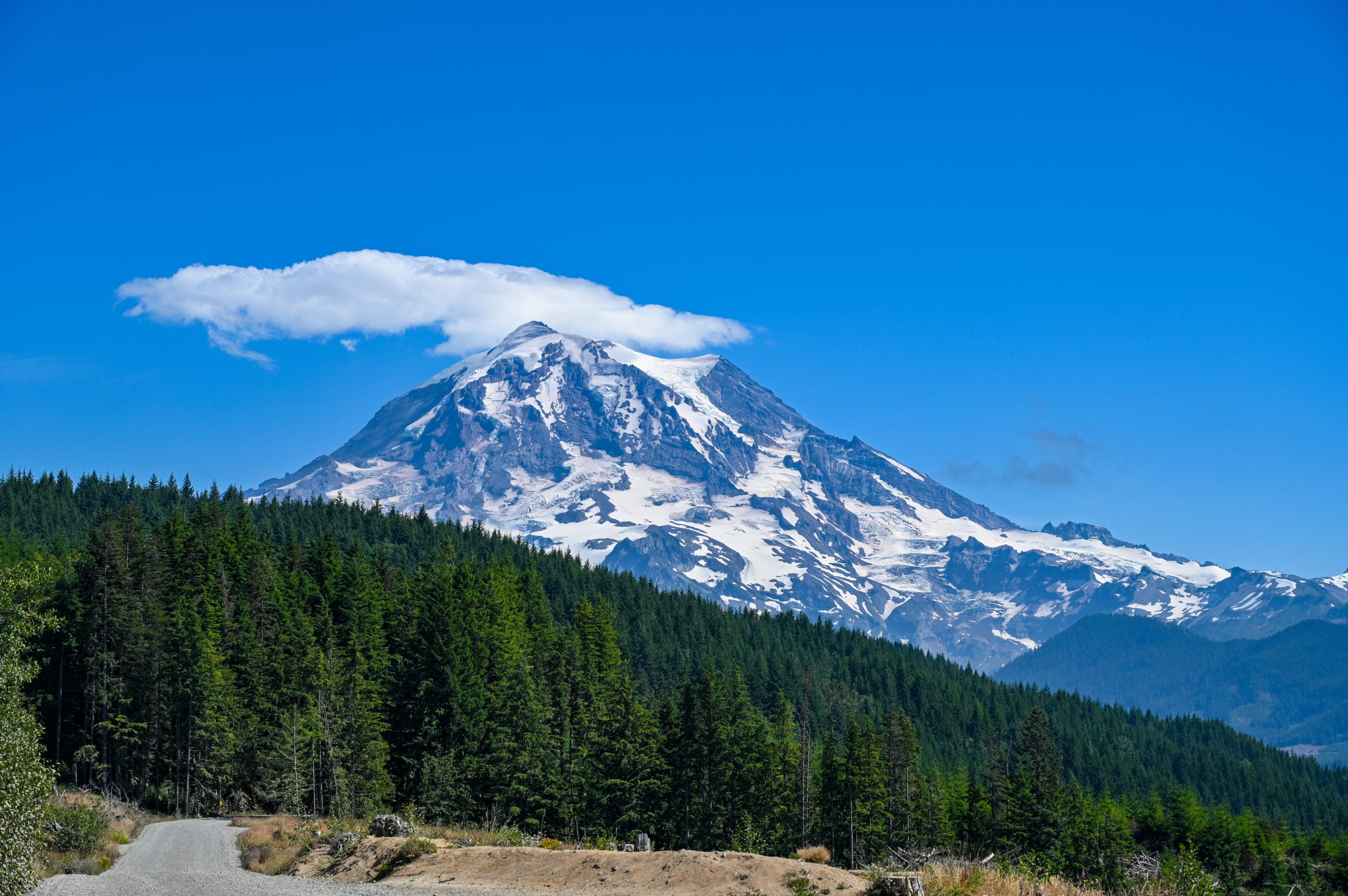
Additionally, I am driving in the direction of the sunlight, so it hits my dirty windshield as I go in and out of the shadows, making it difficult to see. This part of the drive up is the hardest, but on a clear day, the views of Mt Rainier help to pass the time.
I pass by the Paul Peak Trailhead and pay station, I already have an annual national park pass, so I do not need to stop. I’ve only got another 5 miles to go before arriving at the Mowich Lake Parking area.
It’s about 8:30 a.m. when I reach the Mowich Lake parking lot. I count at least 20 cars already parked here, but there is still plenty of parking spaces available. I gather my gear and make a quick stop at the pit toilets. They are clean and include hand sanitizer. I grab my camera bag, which doubles as my day pack and head to the trailhead.
Hiking to Spray Falls and then on to Spray Park
I walk to the Spray Park trailhead just past the pit toilets, and I notice the trail sign says it’s only 6.0 miles roundtrip to Spray Park. My guidebook and other online sources state that it is 8.0 miles roundtrip. The distance you hike depends on how far into Spray Park you want to go. There is no “you’ve arrived” sign, you hike as far into the meadow as you feel like before returning. The further up you go, the better the views.
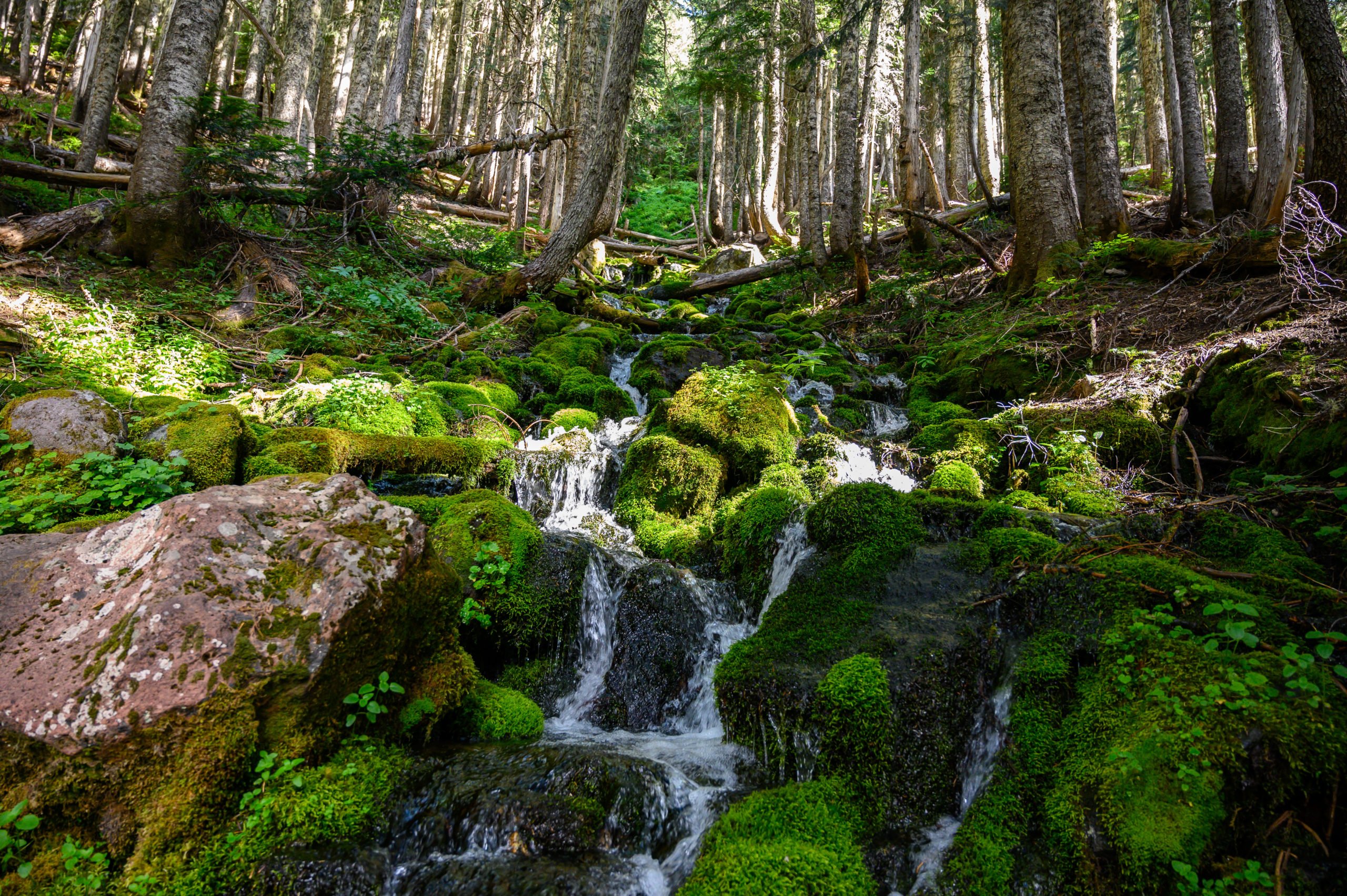
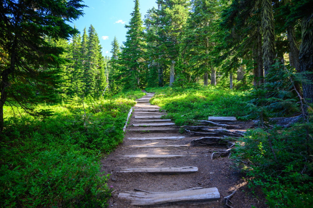
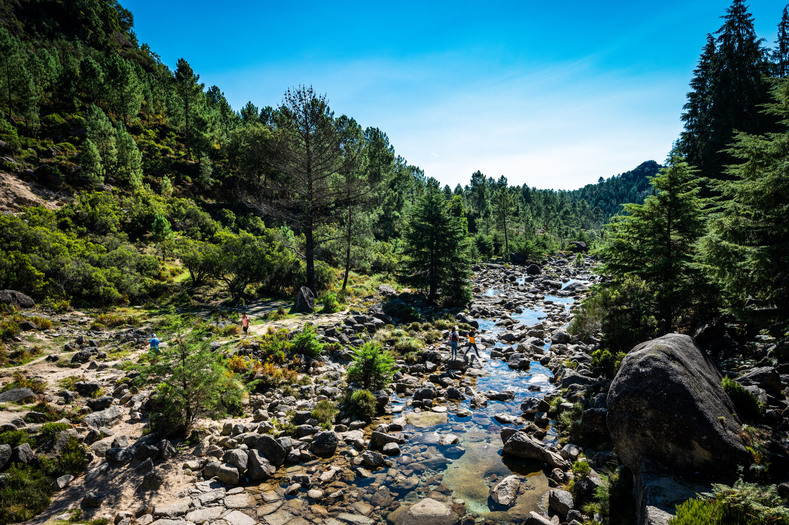
The trail gradually descends into the forest, and soon I cross a small creek. I love the sound of the water as it makes its way over the rocks. The sights, sounds, and smells of the forest are comforting, and it makes me smile. It feels so good to get away and unplug!
Eagle Cliff Viewpoint
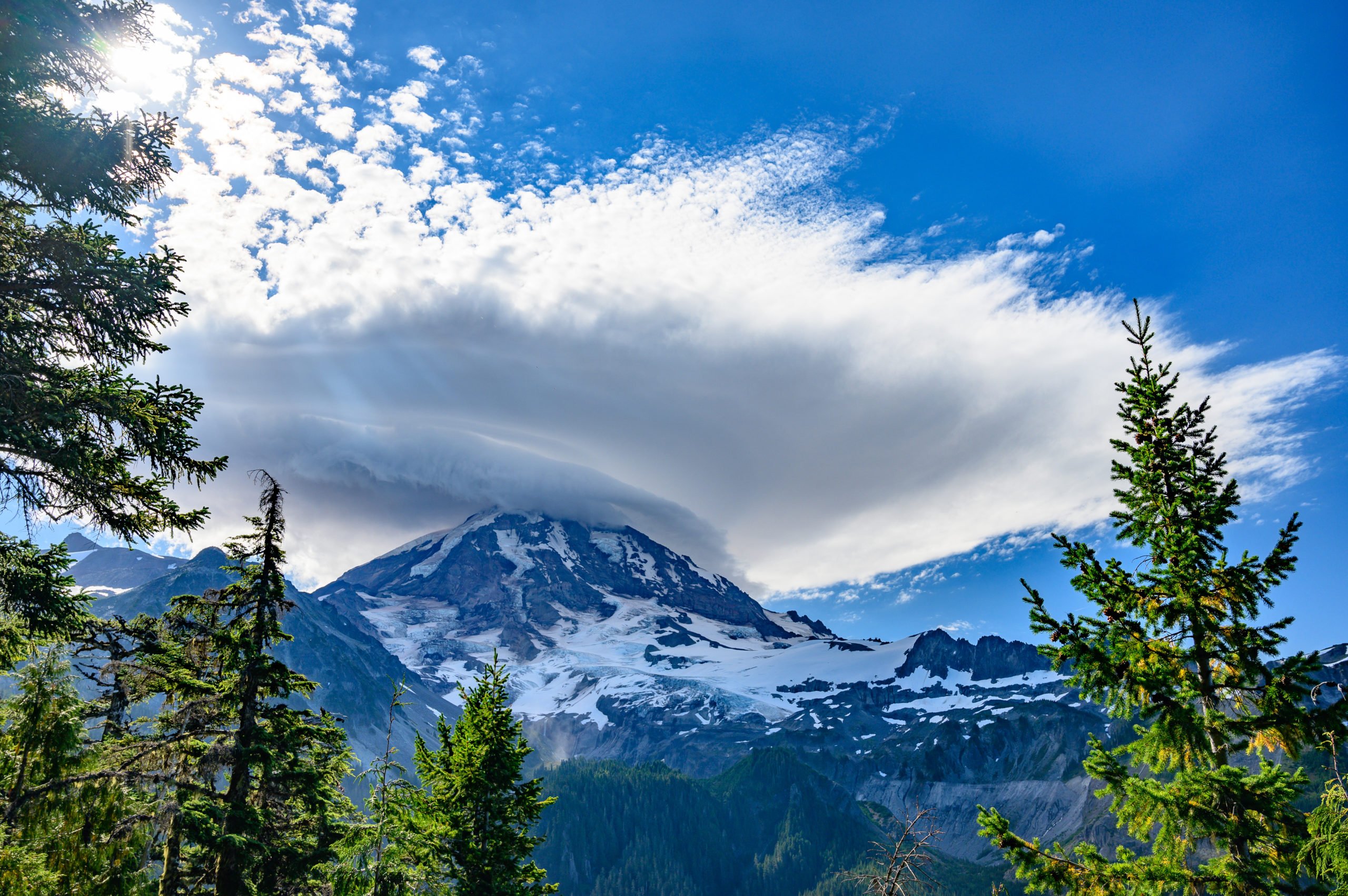
At about 1.5 miles into the hike, I come to the Eagle Cliff viewpoint. Make sure to stop here, it’s only an extra 100 feet of trail, and on a clear day, it has some beautiful views of Mt Rainier. I enjoy a mostly clear view of the mountain during my stop.
After taking some photos, I continue along the main trail, and about .25 mile past Eagle Cliff, I come to the junction for Eagle’s Roost camp. The campground goes to the right, but the trail for Spray Falls and Spray Park continues on the left. I follow the sign for “water .10 mile,” and soon, I cross another wooden bridge and look up to see a series of small cascading waterfalls flowing over mossy rocks. It’s so beautiful.
Shortly after this creek crossing, I arrive at the trail junction for Spray Park and Spray Falls. I head right to take the path toward Spray Falls as I want to stop and see the falls before heading up to Spray Park.
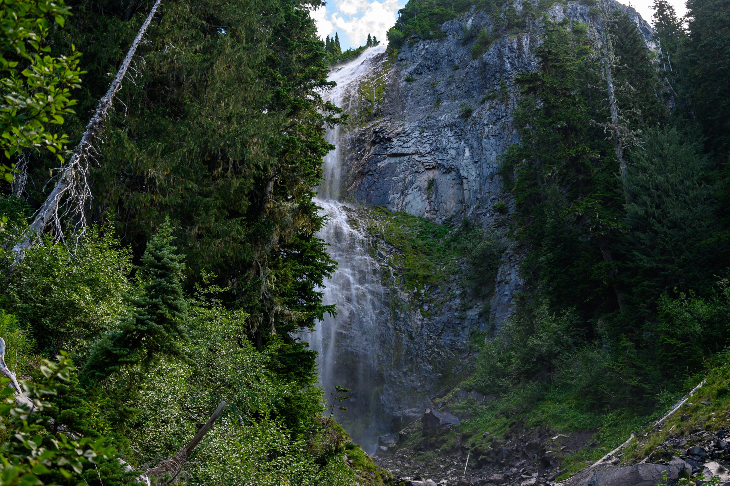
Spray Falls
I’ve seen photos of Spray Falls, and many of them showed people right next to the waterfall. However, I’m not sure what time of the year they visited as this was not possible during my hike here. There was so much water coming down the mountain that I was unable to cross the rushing water to get unobstructed views of the falls.
I was disappointed but unwilling to risk getting my camera gear wet or worse for a better shot. I will try again at a different time when there isn’t so much water rushing down the mountain.
Spray Park
I make my way back to the main trail and start my climb up to Spray Park. The trail sign at the Spray Falls junction says it’s .8 miles to Spray Park. This is where the trail rating turns from “easy” to “moderate.”
I read somewhere that there is only a 600-foot elevation gain for the hike to Spray Falls. However, the hike to Spray Park has a 1700 foot elevation gain. It feels like the majority of that is in this .8 mile hike to the entrance of Spray Park.
As I climb upward, I’m serenaded by the sounds of Spray Falls in the distance. Soon though, I no longer hear the falls as I continue my climb up to Spray Park. “Slow and steady wins the race,” I tell myself, and soon I arrive at a log footbridge, which marks the entrance into Spray Park.
I chat with a dad and daughter who stop by the log bridge for a break. They offer to take a photo for me with my phone, which is nice as typically, I don’t get pictures of myself on these solo excursions. We realize, though, as we stop that the mosquitoes are worse here, and no one wants to linger here too long. Soon the dad and daughter leave to continue their hike into Spray Park.
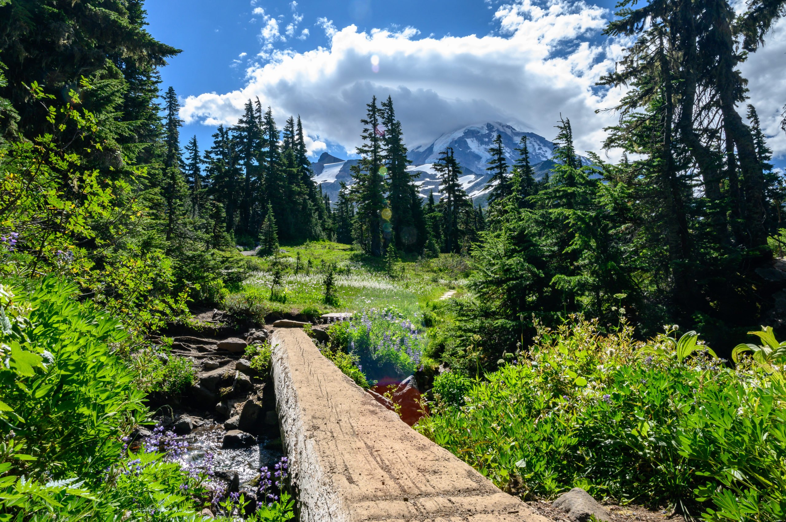
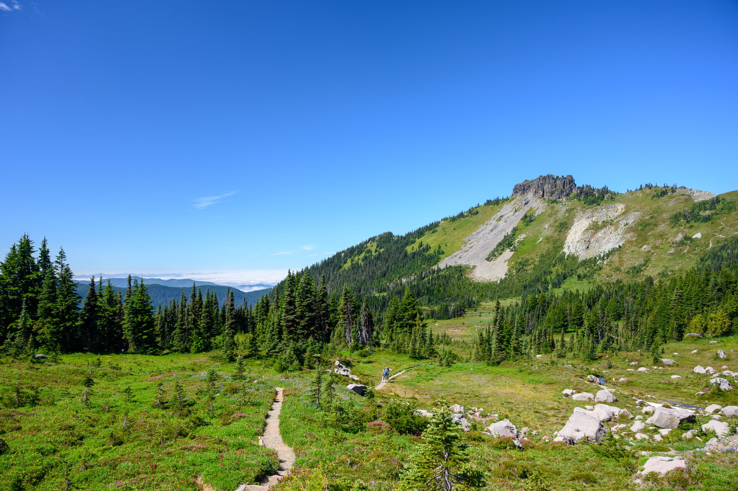
I take a few photographs, and eat a snack and then continue following the trail up. It winds its way through some scattered trees and maintains a steady, but not too steep climb upward. Soon I get views of Mount Rainier on the right and views of Mt Pleasant and Hessong Rock on the left.
Alfred Hitchcock’s “The Birds”
I see a hiker headed my way, and I move to the side to let her pass. As she passes, she tells me there are more beautiful views to come—but, she says, the mosquitoes are “ferocious!” Yes, that was the exact word she used.
She said they get “much worse.” She planned to eat lunch further up in Spray Park, but the mosquitoes were so bad she decided to hike back to Mowich Lake. Great! I thought glumly, as I tend to be a bug magnet. If there’s one bug in the room, it’s going to find me! Now, I wish I’d have brought the can of bug spray with me so I could re-apply.
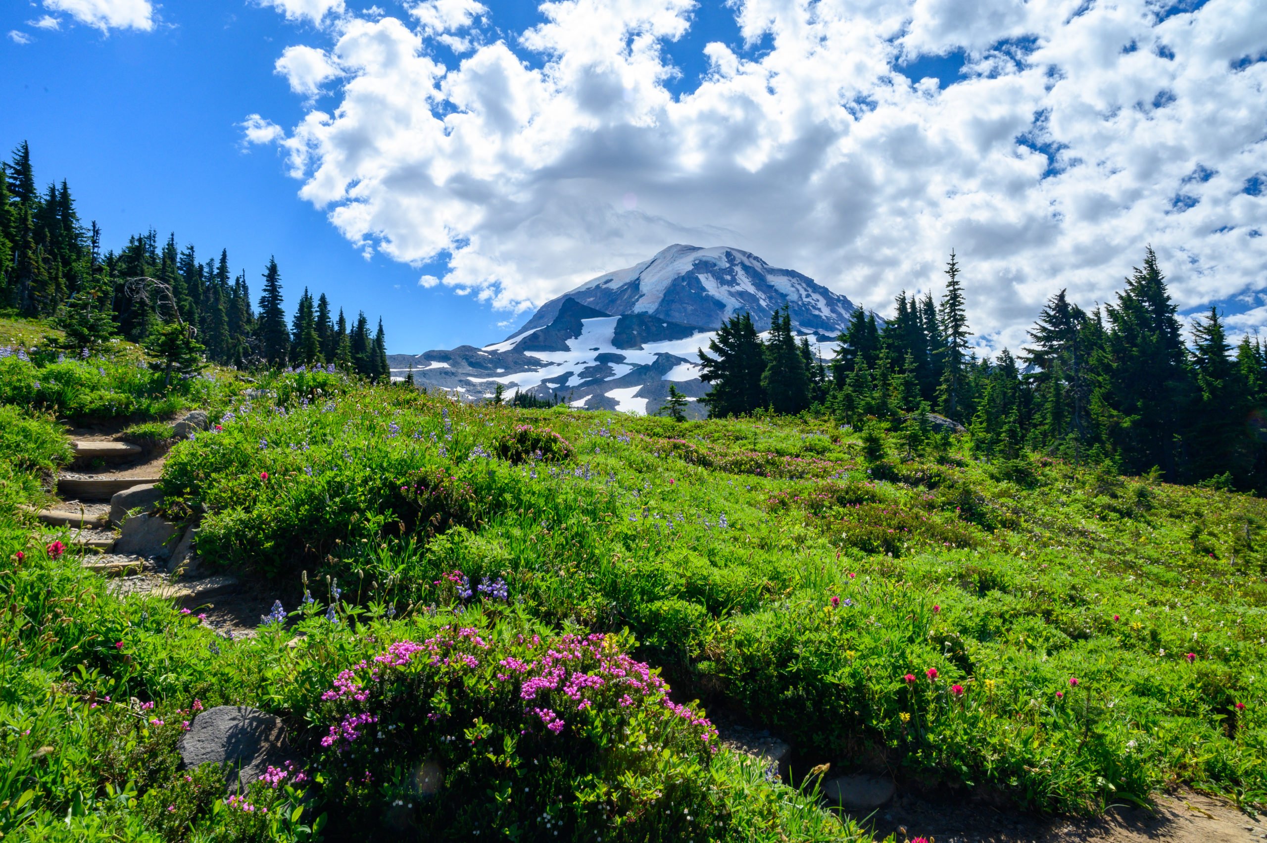
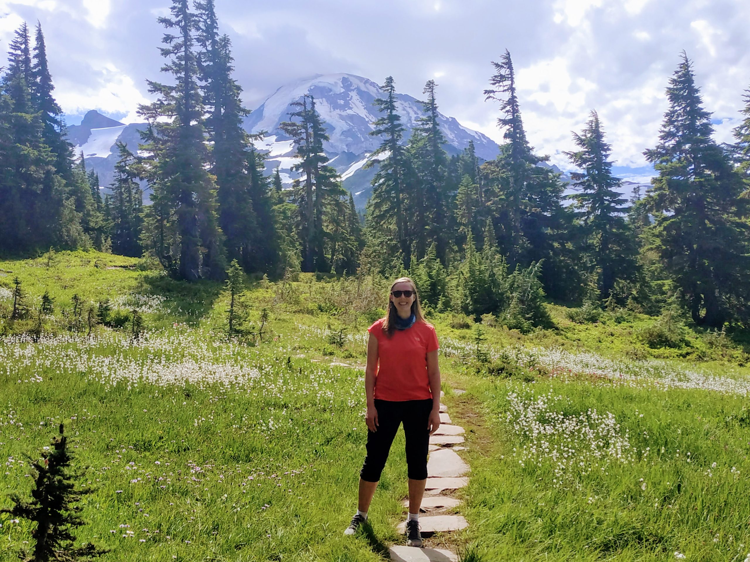
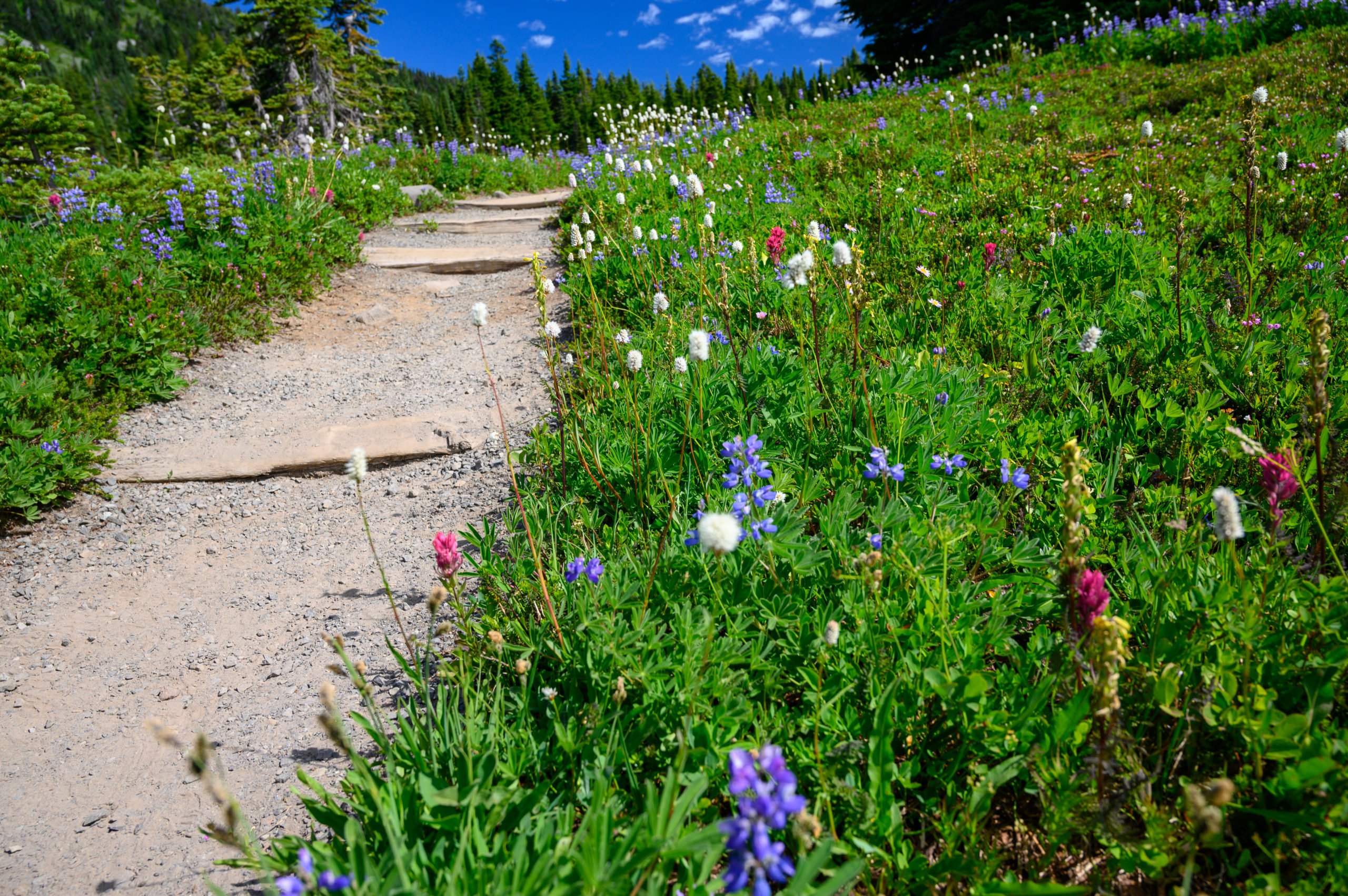
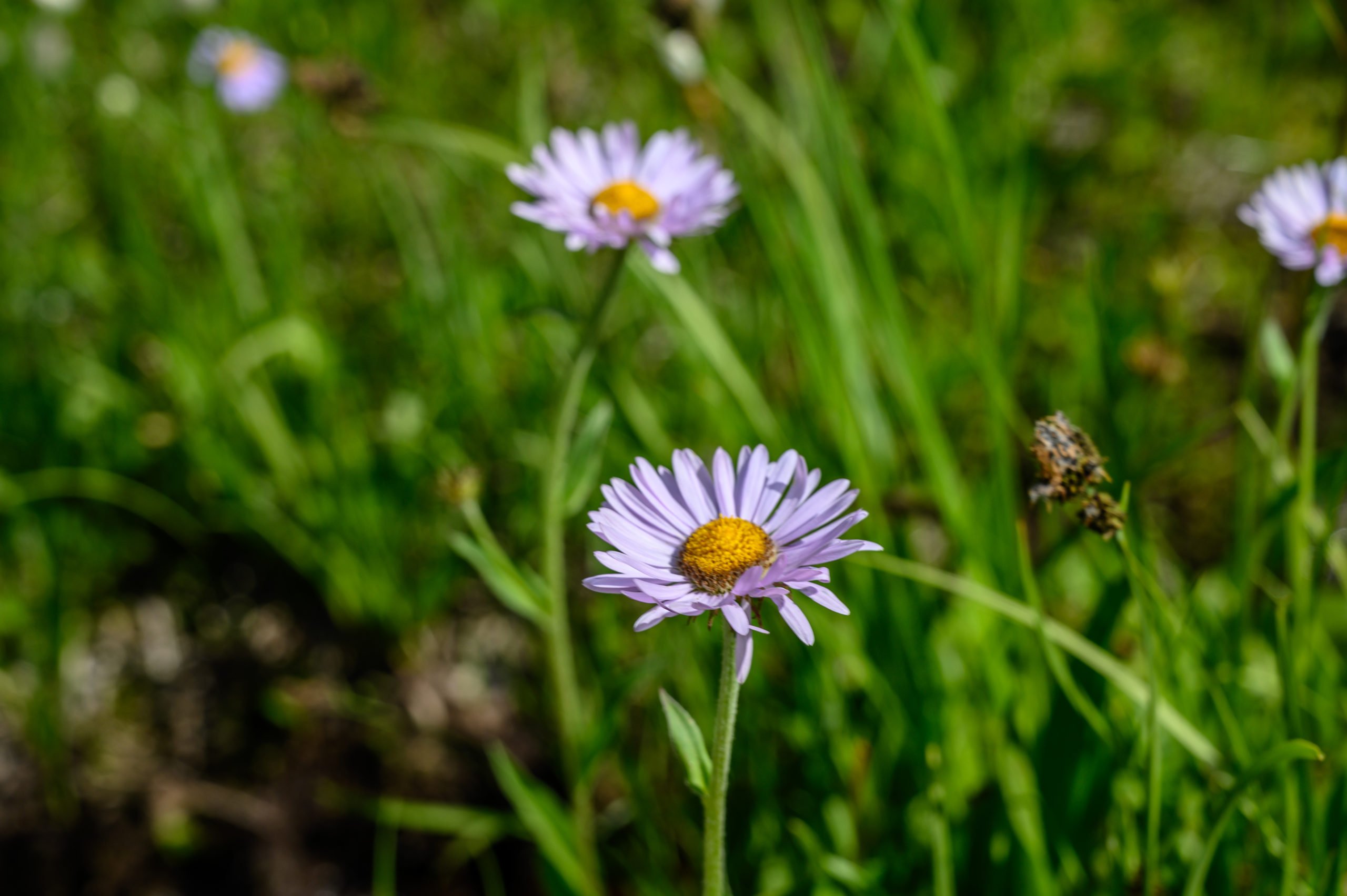
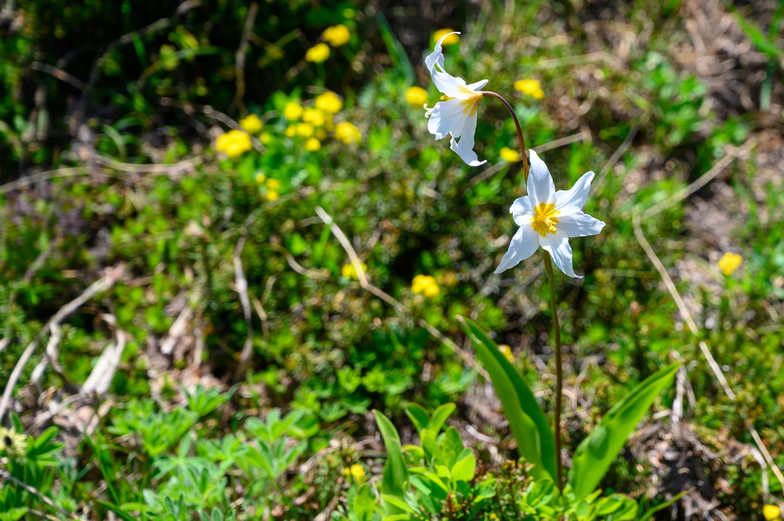
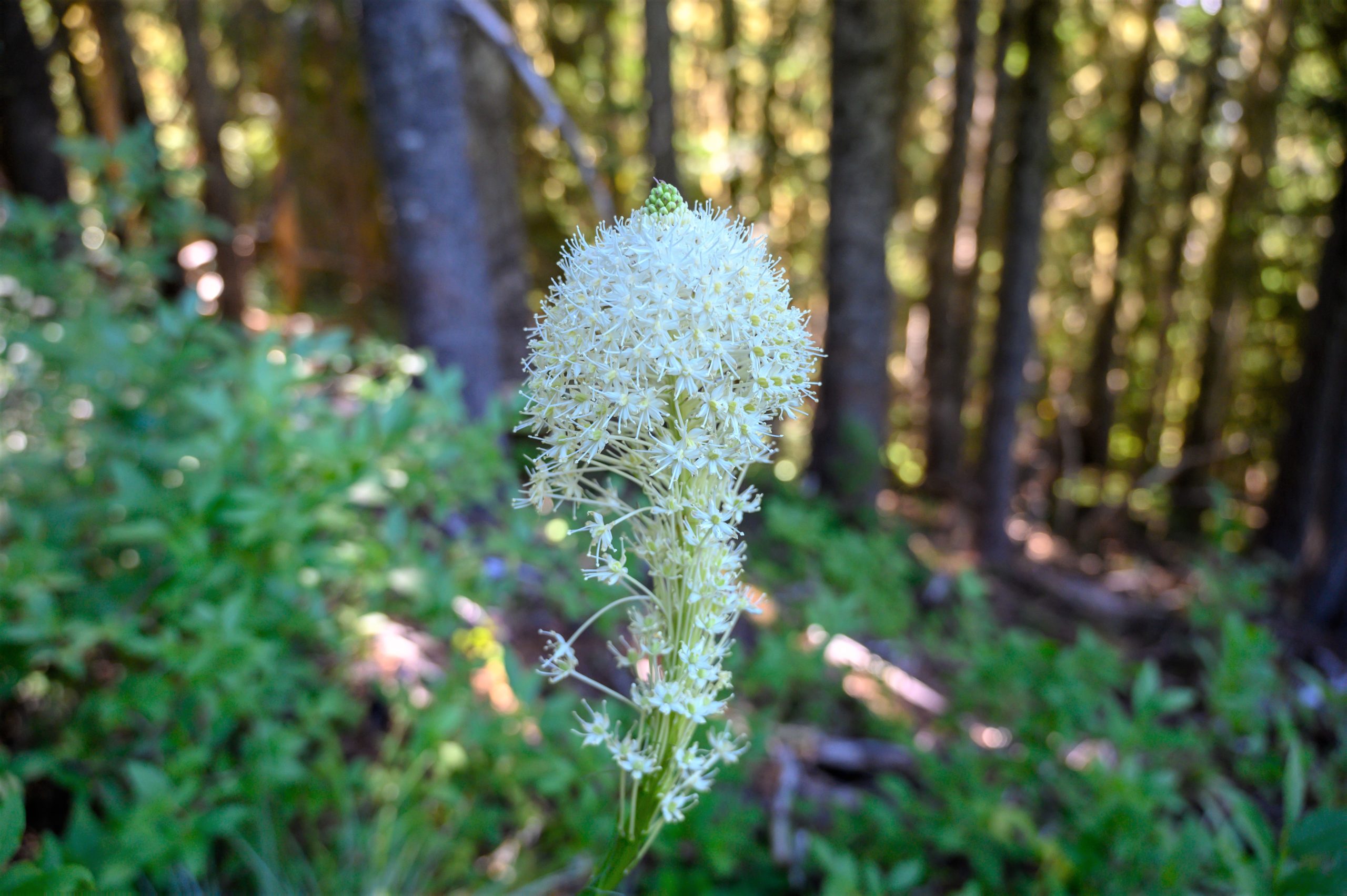
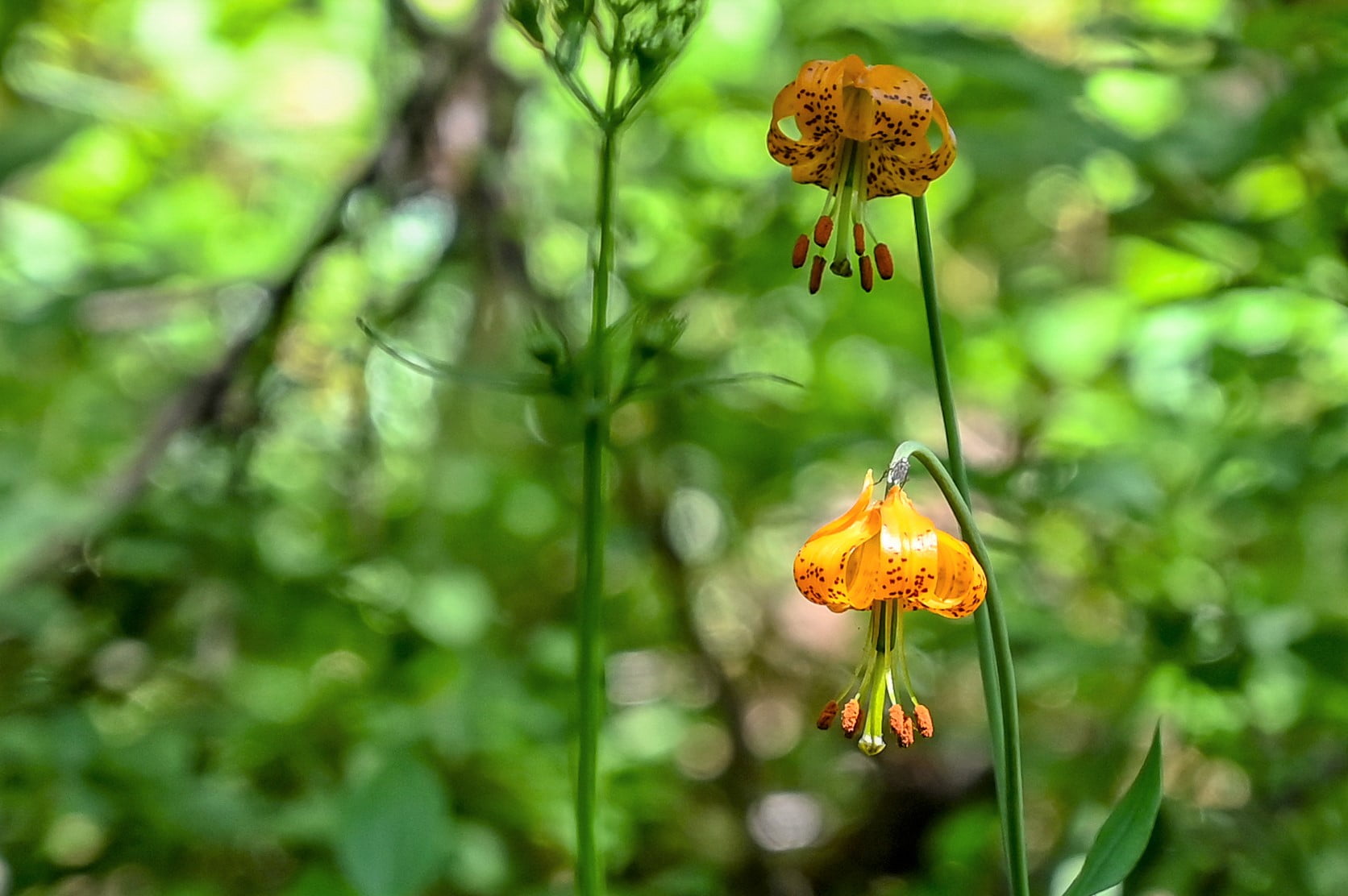
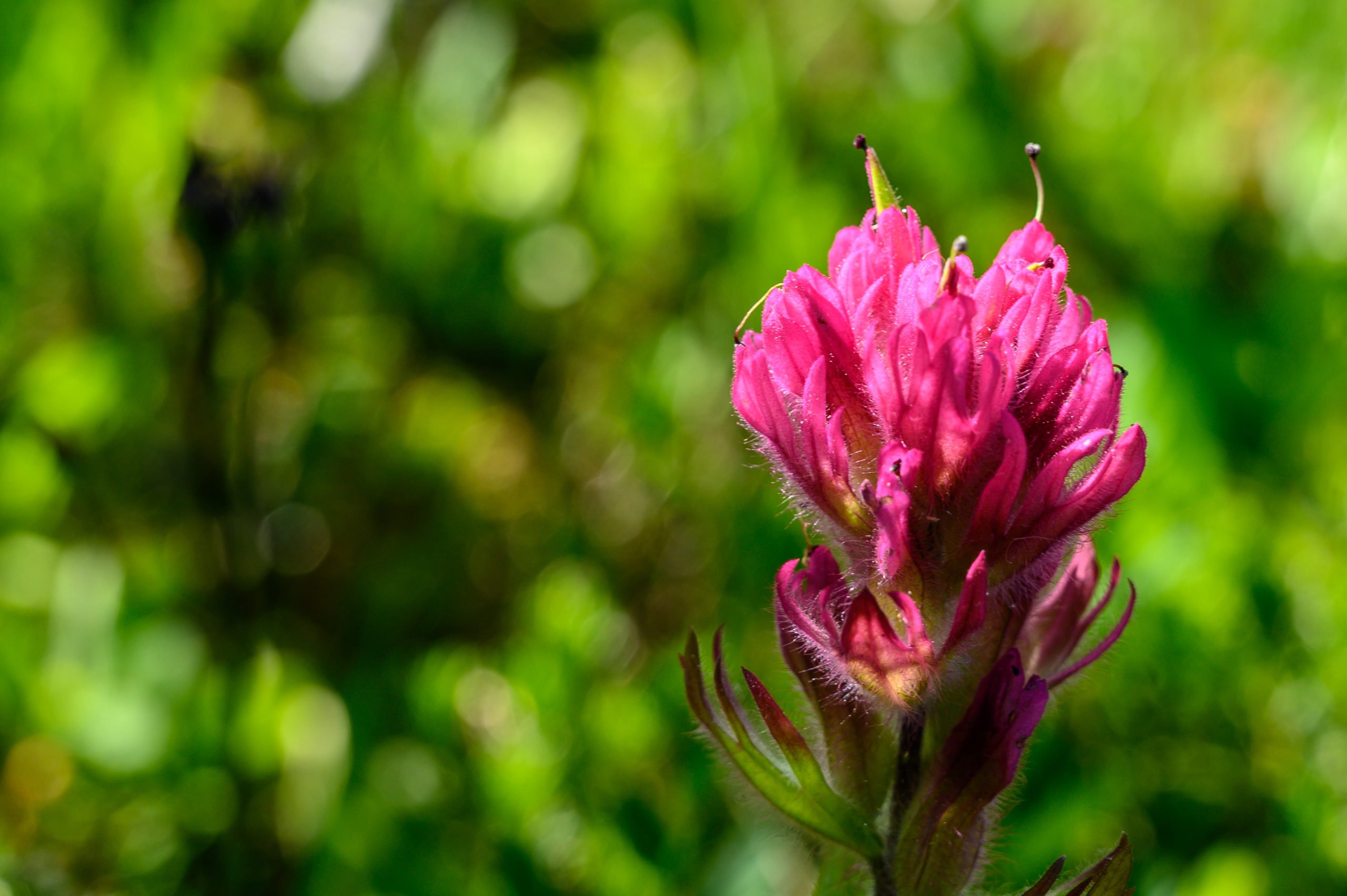
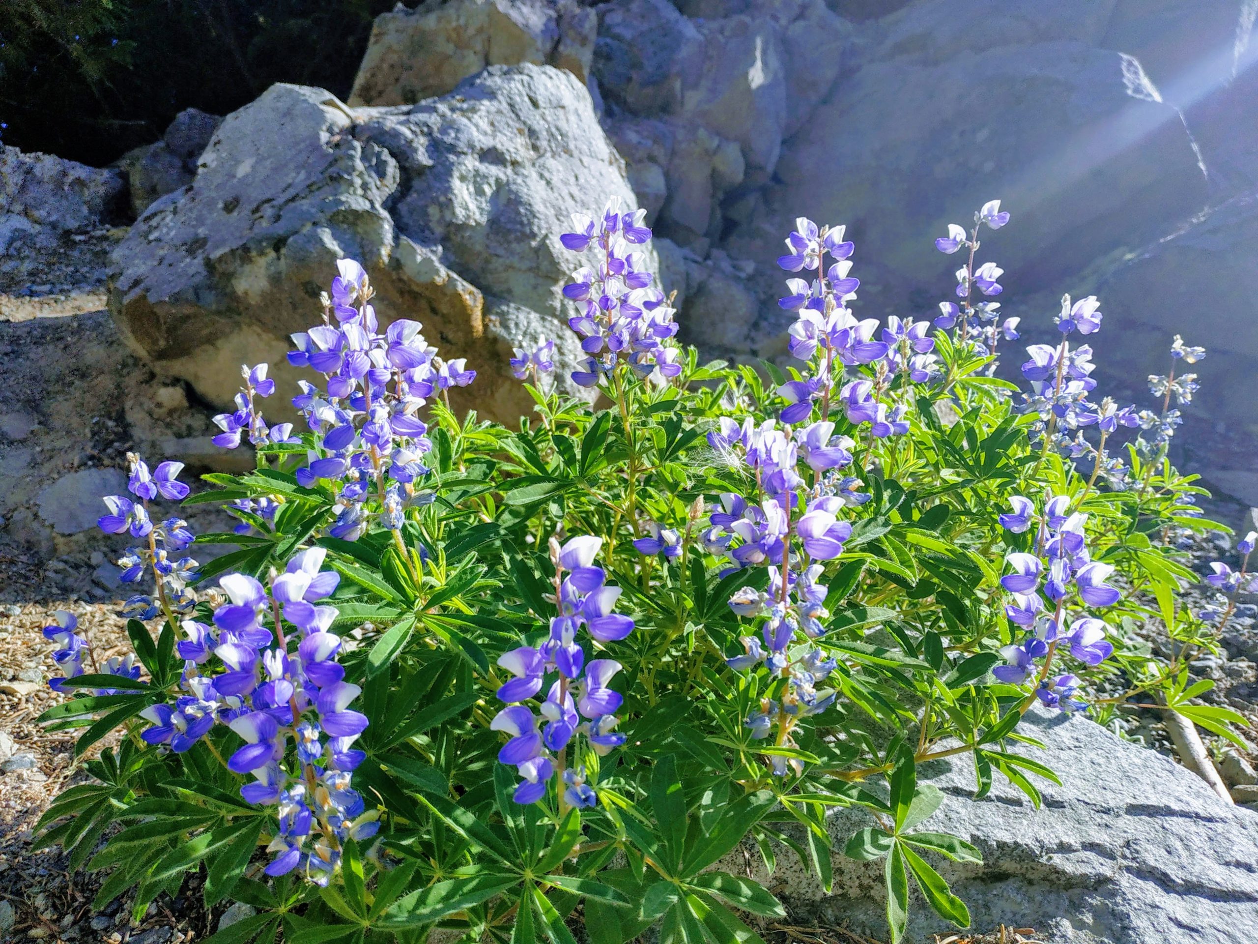
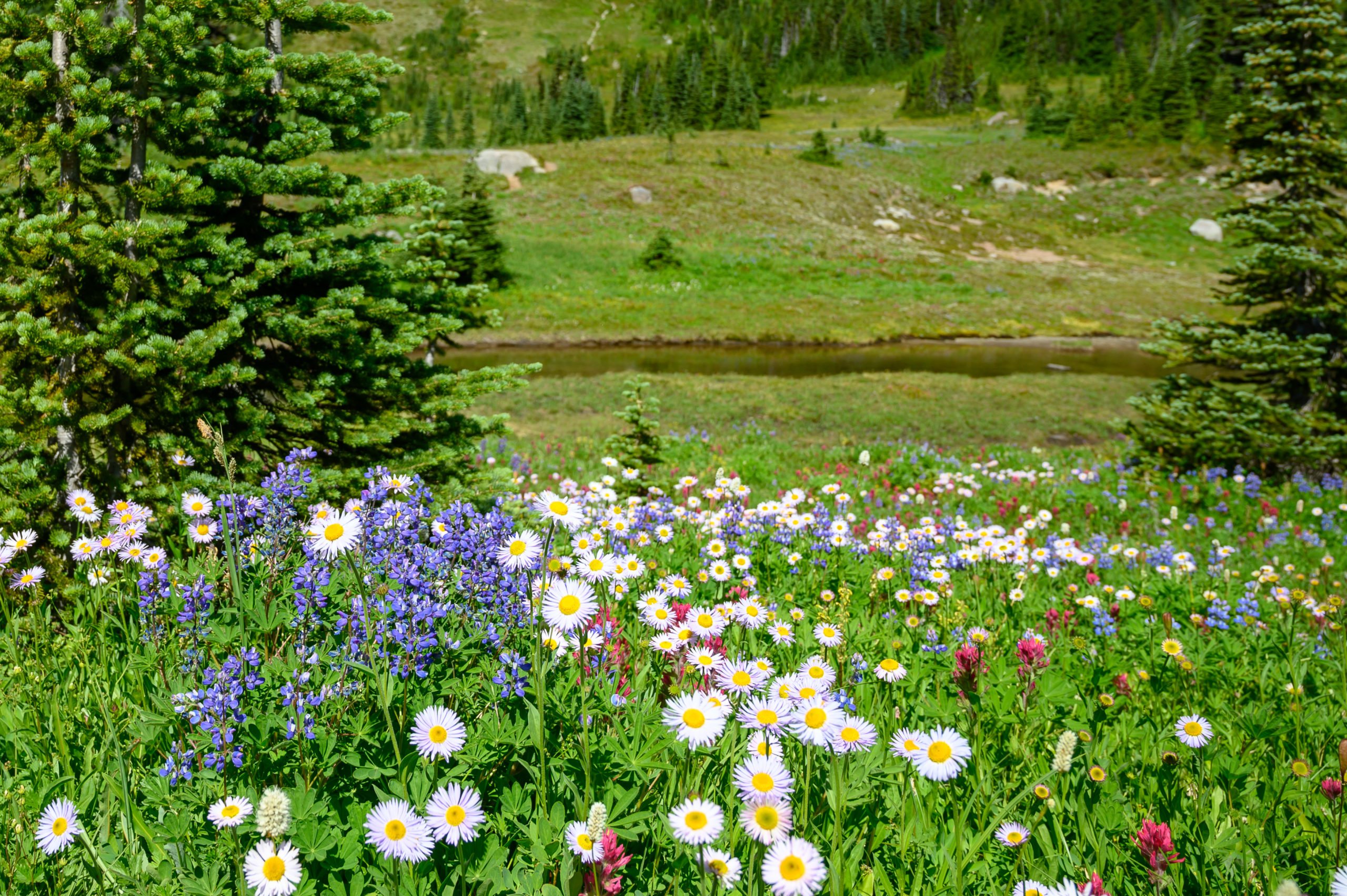
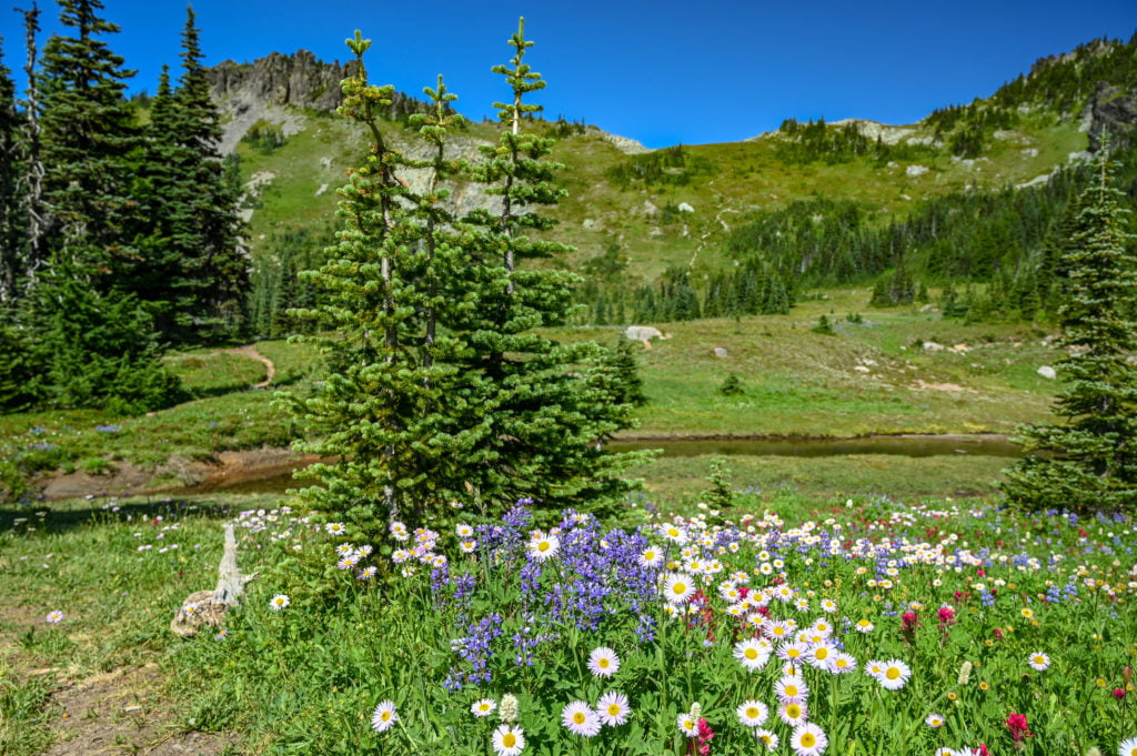
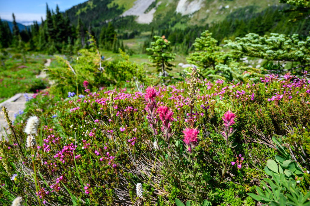
Despite the warning, I continue hiking further into Spray Park, hoping to find “the view.” I love the wildflowers dotting the meadow with beautiful colors!
A little further up, I chat with another dad and daughter on their way back to Mowich Lake. The dad said he’s hiked this trail before and saw seven bears, but this time not a single one. They did get to see some goats, though, so that sounded pretty neat! I love meeting people on the trail and seeing others out enjoying nature and life. I say my goodbyes to the dad and daughter and continue hiking a bit further into Spray Park.
It’s Lunch Time, and I’m on the Menu
It’s about a quarter to noon, and I’m hungry, so I decided to stop for a quick lunch break. I put my bag on the ground to get my water and sandwich, and as I do, a swarm of mosquitoes lands on my backpack. There’s not even any blood for them to get out of my pack!
Of course, they land on me as well, and I do my best to swat them off while trying to take a quick drink and a bite to eat. (Again, if only I’d have brought the bug spray with me!) This lesson will stick with me for about a week as the swelling and itching finally dissipate.
It’s like Alfred Hitchcock’s movie The Birds, except replace birds with mosquitoes and you’d have a pretty accurate description of my experience.
I quickly zip my bag up and decide I too will not be lunching here. I put my pack on, take a few more photos while the mosquitoes make a lunch break out of me, and then decide I’ve got my views for the day. I’m heading back. I couldn’t stop for 5 seconds without being attacked. It just isn’t enjoyable any longer. I did, however, enjoy the views and beautiful flowers. I even saw a patch of snow, but the bugs…

The Bee & The Magic Hat
I descend back into the trees, and soon I pass the junction to Spray Falls and continue toward Mowich Lake. It’s around the Eagle Cliff viewpoint that a bee decides it wants to chase me. I try to ignore it, I wave my hand at it, it flies towards my face, and I try to swat it away without making it angry. It does not want to leave me alone!
So, I start running. I figure if I run a little way down the trail, it will lose interest. Nope. It did not. It kept coming at me. The last thing I want right now is to get stung by a wasp.
I hear voices up ahead, and I jog toward them, a man and woman come into view, and I say, do you have a hat? I have a bee chasing me. The woman says, “a hat?” “Oh, you mean to swat at the bee?” I say, yes! So the man graciously takes his hat off, and you know what? As soon as he takes his hat off, the bee flies away! I am not kidding!
It was quite funny, and we all laughed about his “magic hat.” Then they tell me a story of when they were hiking years ago, and a bee flew up his wife’s nose! It sounded like a horror story to me, but she lived, although she did get stung. I am very thankful the bee left me, but I still heard phantom buzzing noises for a while after I continued down the trail.
The Flat Tire
It takes about an hour for me to hike back to the Mowich Lake Campground from Spray Park. I am tired and a little hungry, but happy to be away from the mosquitoes. As I walk over to my car, I discover that I have a flat tire. I must have run over something on the way up.
I make a stop at the restrooms before changing my tire. As I’m walking back to the car, the dad and daughter duo that I spoke with earlier about seeing the goats spot me and say hi and ask me about my hike.
We chat for a bit, and then I walk over to change my flat tire. I’ve never actually changed a tire on my SUV before. It takes me a little bit to figure out how to lower the tire from underneath the vehicle. I do that, but I am not sure how to now detach it from the cable it is on.
I decided to ask the man I chatted with moments before for help. They were driving past my vehicle to leave for home when I stopped them to tell them about my situation. The man quickly parks his truck and very graciously helps me get the spare tire out from underneath the vehicle and then proceeds to change my flat tire. I am so thankful he stayed to help too as he mentioned the lug nuts were on really tight, and he had a hard time getting them loosened. I am so grateful for the kindness of strangers!
Conclusion to My Hiking Experience
I made it home safely but stopped in Wilkeson to air up my spare tire as it also appears to be losing air. All in all, between being eaten alive by mosquitoes, chased by a bee, and getting a flat tire, I’m not sure I’d do it again if I had to pick those exact circumstances, but I don’t regret going either.
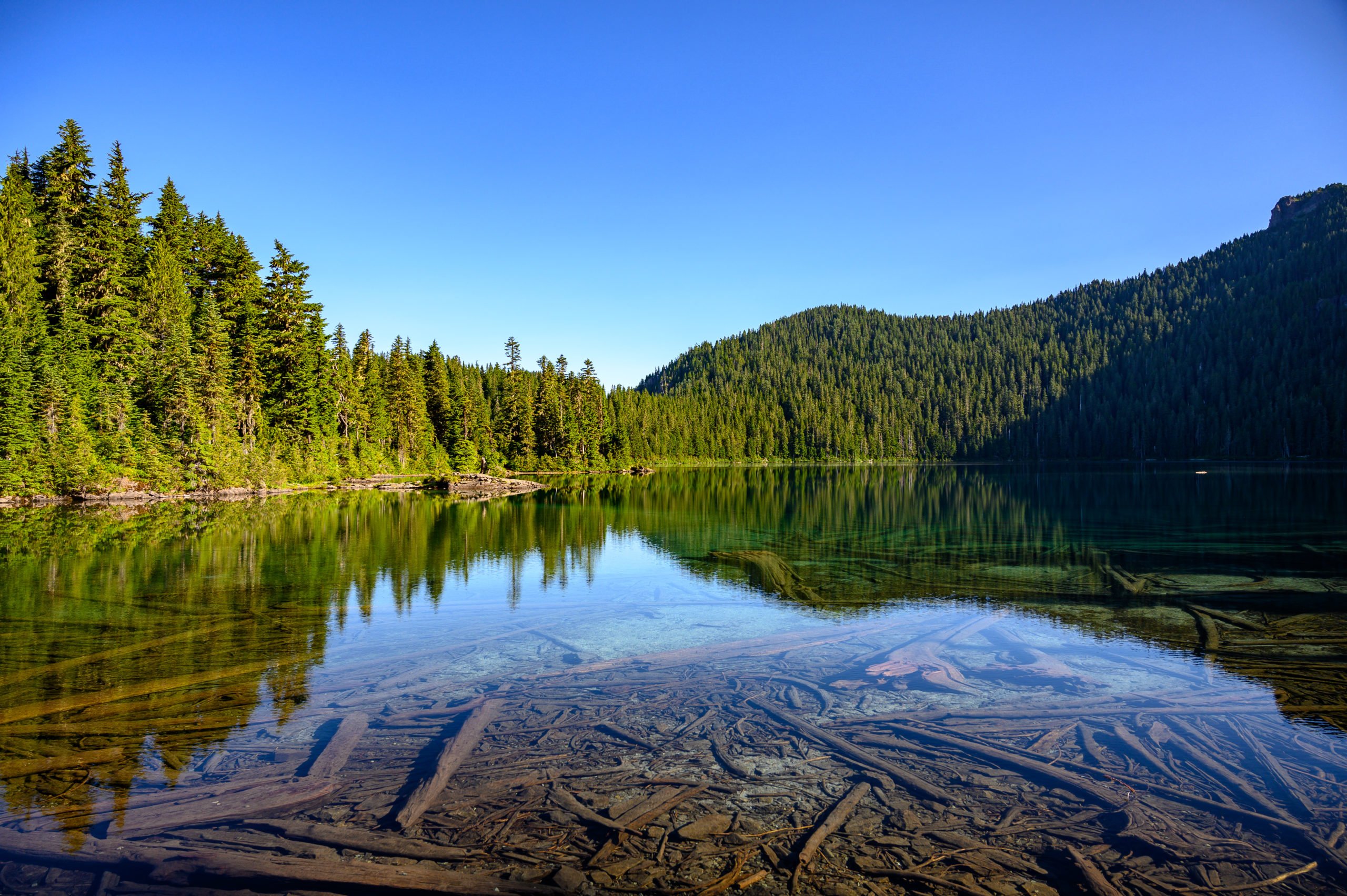
So would I recommend you make the trip to Mowich Lake? Absolutely! The hike to both Spray Falls and Spray Park is beautiful, the wildflowers are stunning, and Mowich Lake is a serene alpine lake accessible by car. I would not want to discourage anyone from going, only to suggest you plan ahead and don’t forget to pack bug spray for the hike!
In addition to applying bug spray in the parking lot, next time I will also bring it with me on the hike. Read my tips on what to pack and how to be better prepared than I was before leaving home.
Getting to the Spray Park Trailhead
The trailhead for Spray Park is in the northwest corner of Mount Rainier National Park in the Mowich Lake campground. As I previously mentioned, you’ll have an almost 17 mile stretch of gravel road leading up to the parking area. The road ends at the parking lot for the Mowich Lake campground. Whether you’re coming from Seattle, Tacoma, or Bellevue, the drive will take approximately 2 hours.
Driving Directions:
From the town of Wilkeson, you’ll drive south on Highway 165 for about 9 miles before coming to a fork in the road. Stay to the right of the fork and continue south toward Mowich Lake. Soon after the road turns into a dirt road, continue along this main road, and in about 9 miles, you’ll come across the Paul Peak Trailhead and pay station. Stop here if you do not already have a National Parks pass.* You only have about another 5 miles to go from the pay station before you reach Mowich Lake. The road ends in the parking lot.
*Please note the Washington Discovery Pass and the Northwest Forest Pass are not the same things as the National Park pass, you need to pay an entrance fee to be within the Mount Rainier National Park boundary. Purchase online ahead of time or stop at the pay station mentioned above.
Know Before You Go
Best Time of the Year to Go: July to October
The road to the Mowich Lake parking lot and Spray Park trailhead is typically only open from mid-July to October.
Fees: $30 for a 7-day park pass/$55 for an annual park pass
You can purchase your national park pass ahead of time online, or you can stop at the pay station on the way up. The pay station is at the Paul Peak trailhead. You will see signs telling you to stop and pay. If you already have a pass, just keep going up the road.
Road Conditions: The last 17 miles of the drive to the trailhead parking area is on a dirt road.
The road is rough and has potholes and washboard conditions along the way—plan for this section of the road to take about one hour to complete. Recommended speeds range from 15-30 mph, depending on the conditions and the vehicle you are driving in. Cars and SUVs alike will have no issue making it. Just take it slow. On a clear day, you’ll have views of Mt Rainier for the drive up.
Fuel Up: Make sure to fuel up your vehicle ahead of time.
The town of Wilkeson is your last stop for fuel on the drive up.
No Cell Service: There is no cellphone service in this area of the park.
Most people will lose cellphone signal in one of the small towns like Wilkeson before you ever hit the dirt section of the road. Let someone know of your hiking plans, so in case of an emergency, they will know where to look. This is always a good idea when hiking in the mountains.
No Pets: Pets are not permitted on any of the trails within Mount Rainier National Park.
No Potable Water Provided: There is no potable water for the Mowich Lake trailheads or campground.
You need to bring enough drinking water with you or a filtration system to filter lake or creek water.
Check the Park’s Website for Alerts: Always check with the park to find out if there are any alerts for road closures or weather alerts you need to be aware of before your trip.
What to Pack for Your Hike
- Bug spray: Do not leave home without it! Bugs are notoriously bad at Spray Park, read my experience below, and make sure to apply and re-apply as necessary. You may also want to bring a mosquito net for your head.
- Layers: I hiked this on a warm August day and didn’t need more than my t-shirt, but I still packed a sweatshirt just in case. Depending on what time of year you are here, you may need more layers, and in case you’re ever stranded on a hike, the extra layer may be a lifesaver.
- Water: There is no potable water, so make sure to pack enough water for your hike, lunch break, and for the ride back down the mountain.
- Food: Make sure to pack snacks and food to keep your energy up. I like to bring snacks I can eat on the go and then a sandwich for my lunch break.
- First aid kit: It’s always good to have a first aid kit with you, in addition to that I also like to make sure I have moleskin when I’m hiking or backpacking, just in case I or someone in my group gets a blister.
- Buff/Bandana: I like the buff I purchased at REI as you can use it as a bandana, hat, face mask, or neck gator. A bandana will also work for most of those situations too.
- Bear spray: You are hiking in bear country, and your odds of seeing a bear while hiking to Spray Park is pretty good. So I recommend bringing bear spray, and if you’re by yourself, consider also getting a bear bell or calling out now and again to announce yourself.
- Hiking/Trekking Poles: These are optional, but useful for crossing small creeks and for keeping your balance over the rocky terrain and roots on the trail.
- Sturdy Hiking Shoes: You may want hiking boots, or you may feel comfortable with good trail shoes. Either way, make sure they’re comfortable and give you enough support. Then pack a pair of flip flops for, after the hike, I always find my feet like to breathe after a hike.
Prepare for the drive: Roadside Tools
Make sure your car is equipped with the necessary emergency roadside tools and make sure you know how to use them. Bring a tire pressure gauge, jumper cables, and a portable air compressor if you have one.
Additionally, I recommend you check your tire pressure before leaving town and also make sure your spare tire is properly aired up.
Spray Falls Hike Overview
Distance: 4.0 miles, round trip
Difficulty Level: Easy
Approximate Hiking Time: 1.5 hours to 2.5 hours
The hike to Spray Falls is a mostly level hike with some smaller rolling hills. There is no significant elevation gain for this hike. The trail is narrow for most of the hike, and there are a lot of roots and rocks embedded in the path. If you have significant issues with your balance, the trail might not be a suitable choice. However, for most people, including families with children, this hike should be a relatively easy hike accomplished in a few hours.
Hiking to Spray Falls
Start at the trailhead for Spray Park. You’ll find the Spray Park trailhead on the right, just past the pit toilets at the Mowich Lake Campground. The trail gradually descends into the forest, and soon you’ll cross a small footbridge over Lee Creek. At about .2 miles into the hike, you’ll come to a trail junction for the Wonderland Trail. Continue to follow the trail signs for Spray Park.
About 1 mile past this trail junction, you’ll come to the Eagle Cliff viewpoint. You’ll see a small trail sign pointing to the right. It is only 100 feet off the main trail. I recommend stopping here for a quick look. On a clear day, you’ll have incredible views of Mt Rainier and the Mowich glaciers.
After stopping at the Eagle Cliff viewpoint, continue on the main trail for about .25 miles where you’ll arrive at another trail junction. The trail sign will point right for Eagle’s Roost Camp, and to the left, it shows water .10 miles. Stay to the left of the fork to continue to Spray Falls.
Soon you’ll reach the trail junction for Spray Falls. You’ll see a sign that points to the right for Spray Falls viewpoint .10 miles. Take the trail on the right and follow this until it ends at the viewing area for Spray Falls.
Retrace your steps to return to Mowich Lake, or continue to Spray Park if you prefer a longer and more challenging day hike.
Spray Park Hike Overview
Distance: 6.0-8.0 miles, round trip
Difficulty Level: Moderate
Approximate Hiking Time: 3.5 hours to 5 hours
The hike to Spray Park is moderately challenging. However, I feel if you’re in reasonable shape, it should be one you can manage with relative ease. For some comparison, if you’ve ever hiked to Poo Poo Point, I find the uphill gain to be similar to Spray Park. The real uphill climb starts at the junction for the Spray Falls viewpoint. This is where the trail switches from easy to moderate difficulty.
The trail is narrow for most of the hike, and there are lots of rocks and roots and a variety of creek crossing, so I recommend sturdy hiking shoes and hiking poles will also be helpful, especially if you have troublesome knees.
The park trail sign shows 6 miles roundtrip; however, my guidebook shows 8 miles roundtrip. That is because Spray Park is a large area, and how far you choose to hike into Spray Park will determine how long your hike is.
Hiking to Spray Park
Follow the directions above for Spray Falls until you reach the junction for Spray Park and Spray Falls. From the junction for the Spray Falls viewpoint, the trail sign shows .8 miles to Spray Park. This distance brings you to the beginning of Spray Park. You’ll know when you’ve reached it as you come into an open area and begin moving outside of the treeline into an alpine meadow.
You’ll soon have views of Hessong Rock and Mount Pleasant to your left and views of Mount Rainier to your right. You can hike an additional mile or so further to see more viewing areas, depending on how you feel or how far you wish to go.
Depending on the time of year that you go, if you hike far enough into Spray Park, you will come to the area known as Seattle Park. Snowfields often surround this area, and I’ve read in the earlier months that hikers often get lost in the snowfields. I was here in August during a heatwave, so that wasn’t an issue, but be cautious and play it safe if you come when it is snowy, it’s better to turn around than to get lost.
After enjoying your time in Spray Park, head back the way you came to Mowich Lake campground.
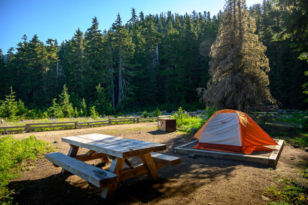
Camping near Spray Park
You have a couple of campground options if you want to turn your day hike into an overnight trip.
Mowich Lake Campground
Mowich Lake campground is a walk-in, tent sites only, first come first served primitive campground. The walk from the parking lot to the campsites is a short one, though, and they provide a wheelbarrow to help you carry your supplies from the car. The tent sites are set around a dirt circle, and there is no privacy between campsites. Bear boxes are provided for your food and gear.
What this campground lacks in amenities and privacy, it makes up for in beauty and location. Mowich Lake is a gorgeous alpine lake! You can bring your SUP or kayak and enjoy time in this serene mountain setting. It is also a fantastic base camp for hiking trails in the area.
- Fee: There is no fee to camp here. Campers self-register at the campground, and no wilderness permit is required.
- No Fires Allowed
- Pit Toilets
- No Potable Water (You must pack your water in, or bring a filter to filter lake or creek water.)
Eagle’s Roost Camp
This backcountry camp is an excellent place for a beginner backpacking trip or an overnight family backpacking trip. The camp is located about 2 miles from the Mowich Lake campground, and it takes approximately one hour to hike there. There are seven campsites with bear poles provided for hanging your gear. Remember, you are in bear country, so make sure to take the necessary steps to keep yourself safe.
- Fee: $20 per trip (good for up to 14 days). You also need a wilderness permit to stay here.
- No Fires Allowed
- Pit Toilets
- No Potable Water (You must pack your water in, or bring a filter to filter lake or creek water.)
Additional Tips for your Trip & Other Articles You Might Enjoy
Come during the week to avoid the crowds. If you do come on a weekend during July and August, plan to arrive early in the morning. This gives you the best chance to get a parking spot and completing the hike before the crowds come.
Sometimes it is easy to think “I’m not going that far” and, therefore, not perform vehicle checks you might otherwise do for a more extended road trip. However, anytime you’re going to drive up a mountain or be out of cell service range, it’s good to make sure you are adequately prepared! Also, make sure to let someone at home know where you’re going and what your hiking plans are, just in case of an emergency.
Other articles for things to do in Mount Rainier National Park:
Have fun and create beautiful memories!
Written by
Charity
Traveler, coffee enthusiast, and storyteller — exploring destinations one sip at a time.
Share this story
Keep Reading
Keep Reading

More Adventures
Explore More
An Amazing Day Trip to Haleakala National Park
Spend an amazing day at Haleakala National Park. Enjoy driving through Maui's Upcountry and then high above the clouds to Halekala's summit.
Read More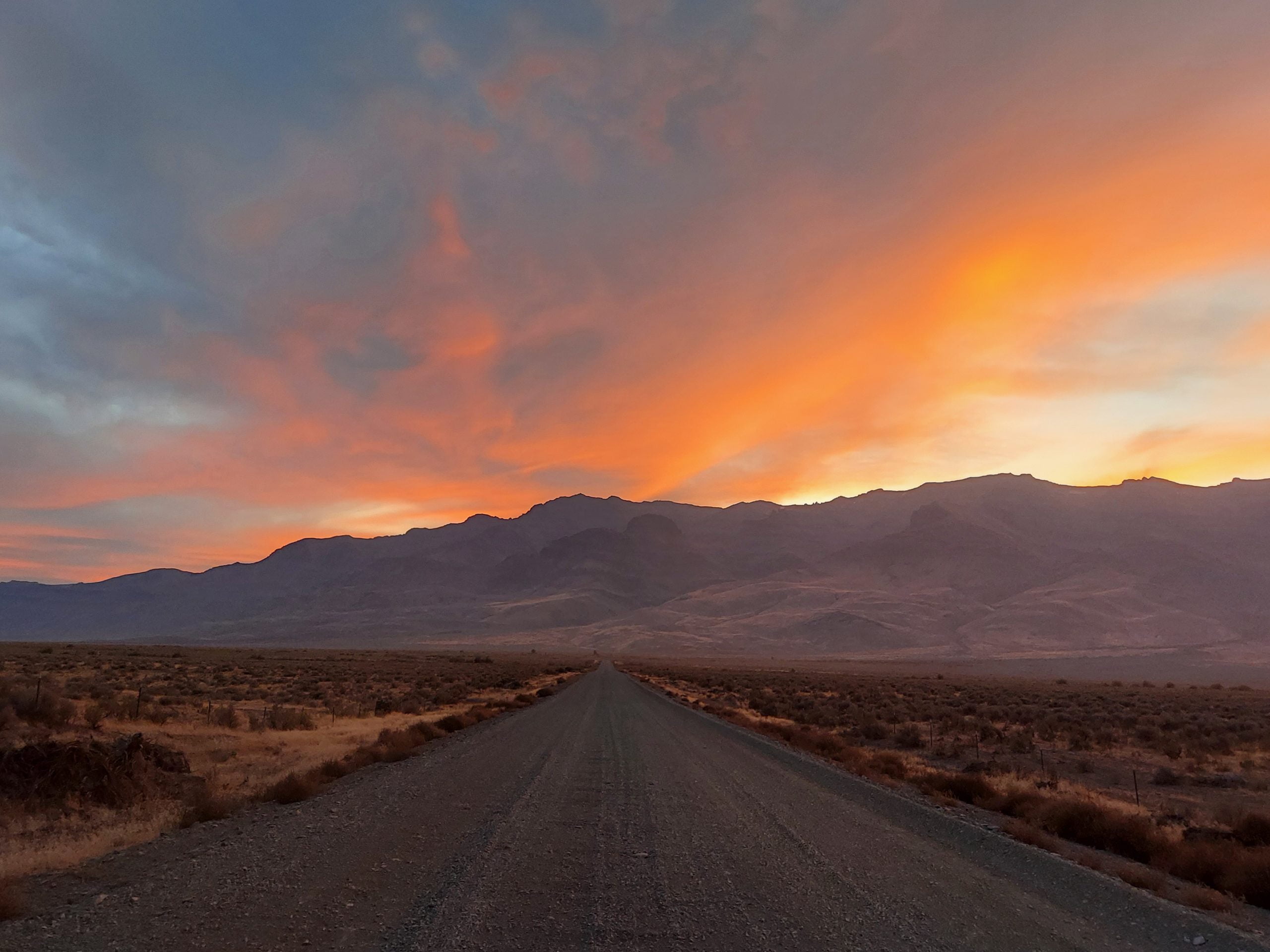
An Incredible One Week Oregon Road Trip
This Oregon road trip itinerary covers some of the remote and rugged areas of Oregon. Discover its natural beauty and unique landscapes.
Read More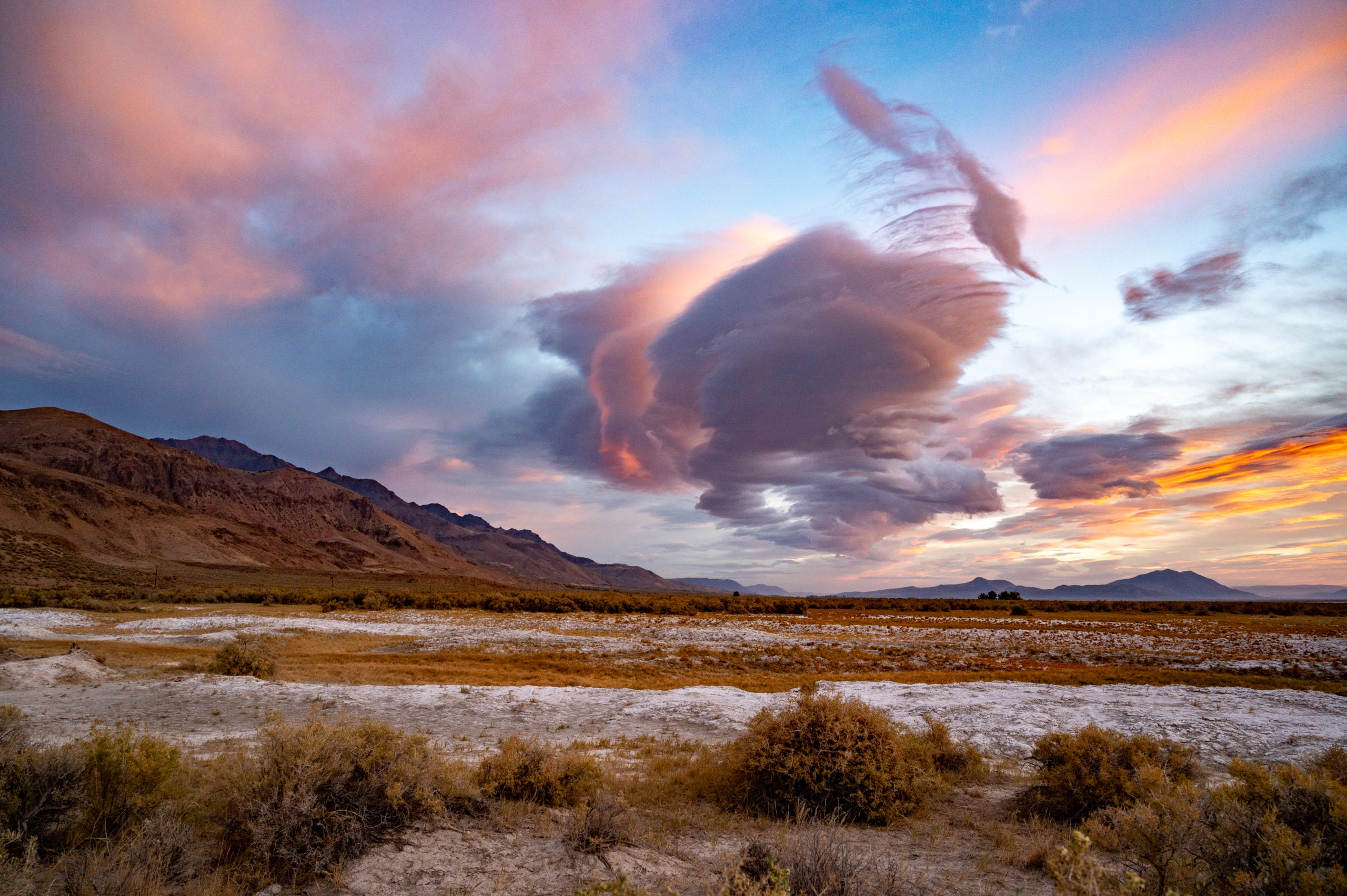
Exploring Alvord Desert and Hot Springs in Oregon
The Alvord Desert in Oregon State is a unique destination. A dried up playa perfect for racing, star gazing, and soaking in a hot spring.
Read More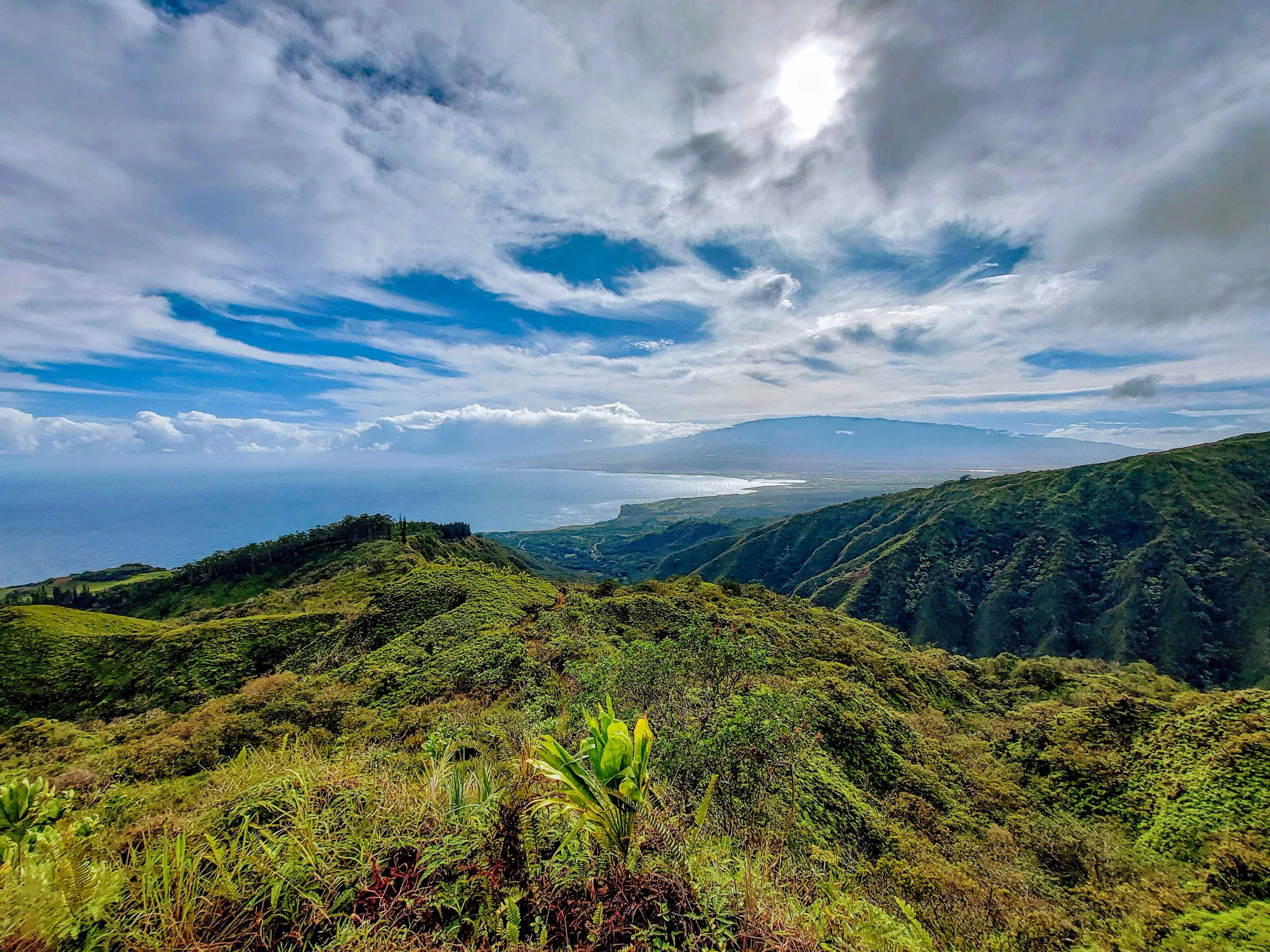
Waihee Ridge Trail: A Local Favorite on Maui
Waihee Ridge Trail is full of gorgeous scenery! Waterfalls, ocean views, unique fauna, and emerald canyons are found on this popular trail.
Read MoreRecent Posts

Keep Reading
You Might Also Like
- Destinations
An Amazing Day Trip to Haleakala National Park
Spend an amazing day at Haleakala National Park. Enjoy driving through Maui's Upcountry and then high above the clouds to Halekala's summit.
Read more - Destinations
An Incredible One Week Oregon Road Trip
This Oregon road trip itinerary covers some of the remote and rugged areas of Oregon. Discover its natural beauty and unique landscapes.
Read more - Destinations
Exploring Alvord Desert and Hot Springs in Oregon
The Alvord Desert in Oregon State is a unique destination. A dried up playa perfect for racing, star gazing, and soaking in a hot spring.
Read more