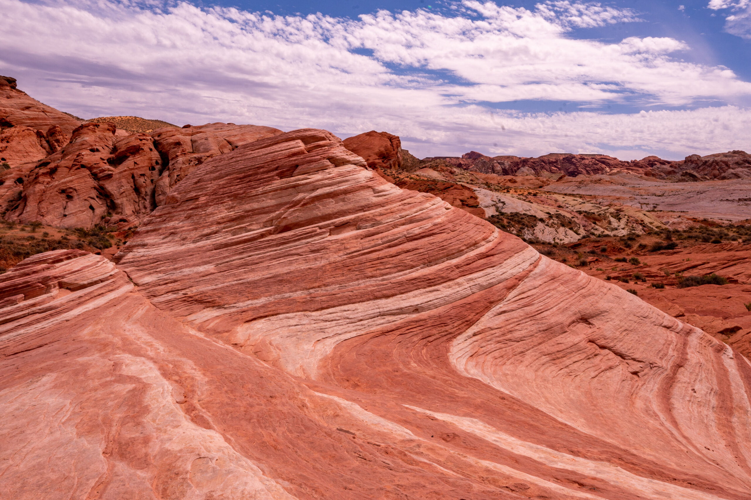
The Fire Wave at Nevada’s Valley of Fire State Park is a gorgeous sandstone formation. With its swirling patterns of reds, pinks, and white, the Fire Wave makes for beautiful landscape photography. In less than a 1-hour drive from Las Vegas, you enter a photographer’s paradise. Plus, for those looking for an alternative to “The Wave” in Utah, the Fire Wave at Valley of Fire makes a great choice! No special lotto is required. The Fire Wave trail was one of my favorites during my day trip to Valley of Fire State Park. Below I share my experience hiking to the Fire Wave, plus information on an alternate route I discovered while hiking to the Pastel Canyon.
Getting to the Fire Wave Trailhead
From Las Vegas, take I-15 N to Exit 75. After exiting, follow signs for Valley of Fire. It is about another 12 miles along the Valley of Fire Highway before you reach the entrance station for the park. It takes about 1-hour to drive there from Las Vegas. After entering the park, and paying the park entrance fee, continue straight for about 2.5 miles. Make a left onto Mouse’s Tank Rd (you’ll see signs for the Visitor Center and White Domes). Continue up Mouse’s Tank Road for almost 5 miles before coming to Parking Lot 3 (P3 on the map). The trailhead starts from the parking area on the right when heading north toward White Domes. Park in the gravel parking lot on the righthand side of the road. If that lot is full, you can check the parking lot on the opposite side of the road.
About the Fire Wave Trail
Trail Length: 1.5 miles (roundtrip) Elevation Gain: ~ 236 feet Trail Difficulty Rating: Easy Features: Colorful Sandstone and limestone, swirling wave-like sandstone rock formation, desert landscape and native plants Entrance Fee: There is a $15 day-use park fee per vehicle ($10 for NV plates) Restrooms: There are no restrooms at the trailhead. You can stop at the Visitor Center on the way to the trail. Open Hours: Sunrise to Sunset
What to Bring
Lots of water! This trail has only a small portion of shade at the beginning of the hike when you descend the sandy trail. After that, you are completely exposed to the sun for the rest of the hike. The Park rangers have closed this hike during extreme temperatures due to many hikers needing to be rescued for heat-related illnesses. I own a collapsible water bottle like the one below, and it’s great for traveling! You can easily stow it when you don’t need to keep water in it, and they’re great to bring to the airport and then fill up at the water fountain. 

Overview of the Fire Wave Trail
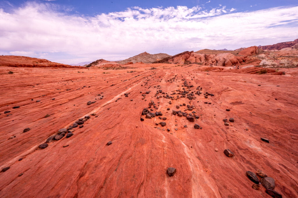
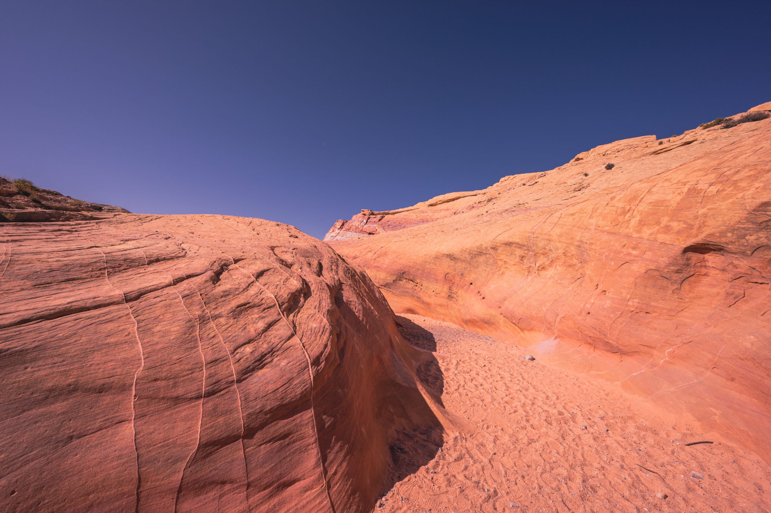
The trail to the Fire Wave is mostly flat. The first part of the trail has an initial descent, but after that, it is mostly a flat, rocky, and sandy trail. The trail is well marked in the beginning. However, after your initial descent, you’ll want to continue straight and look for the few trail markers scattered along the rocky stretch leading to the Fire Wave. Chances are you won’t be alone, so you can also look ahead for other hikers.
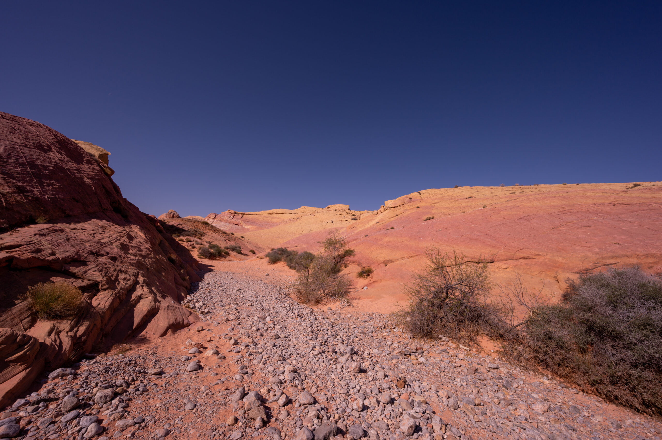
Hiking to the Fire Wave
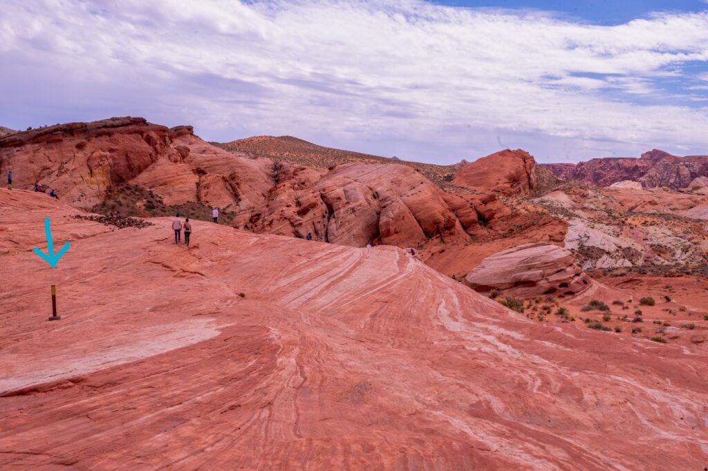
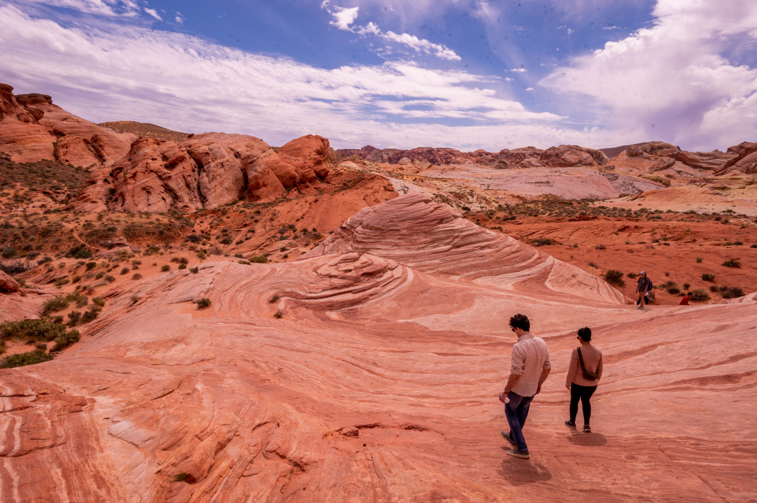
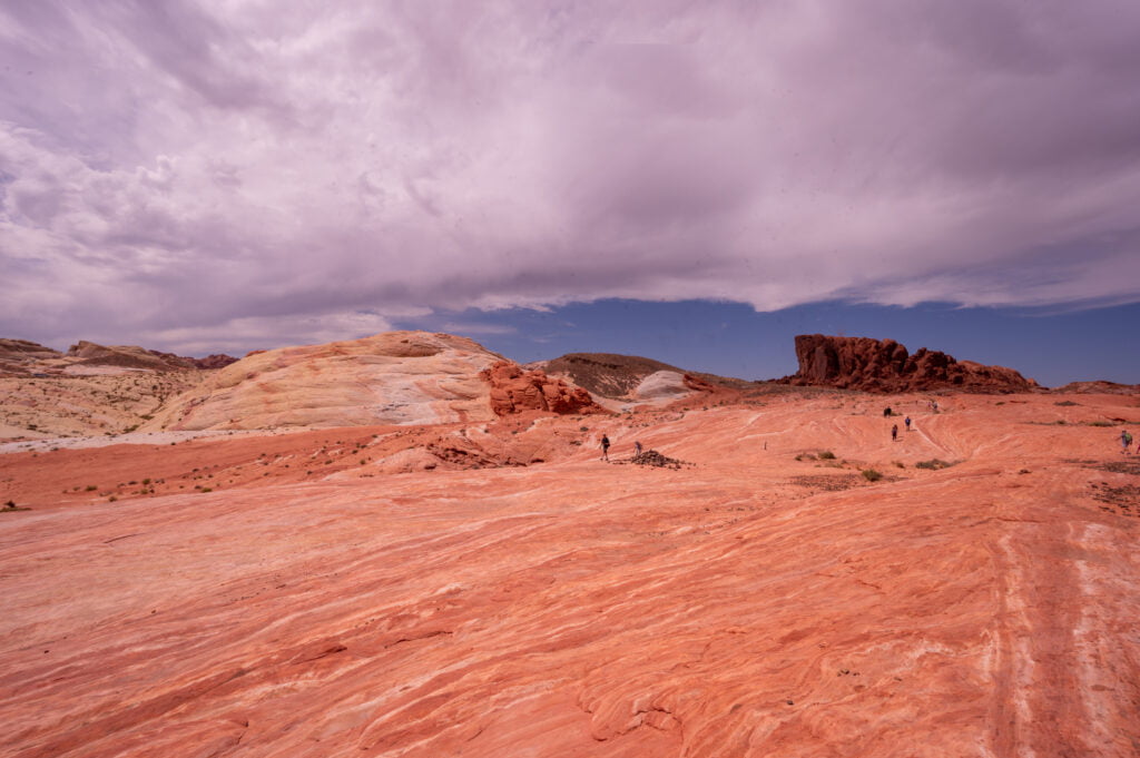
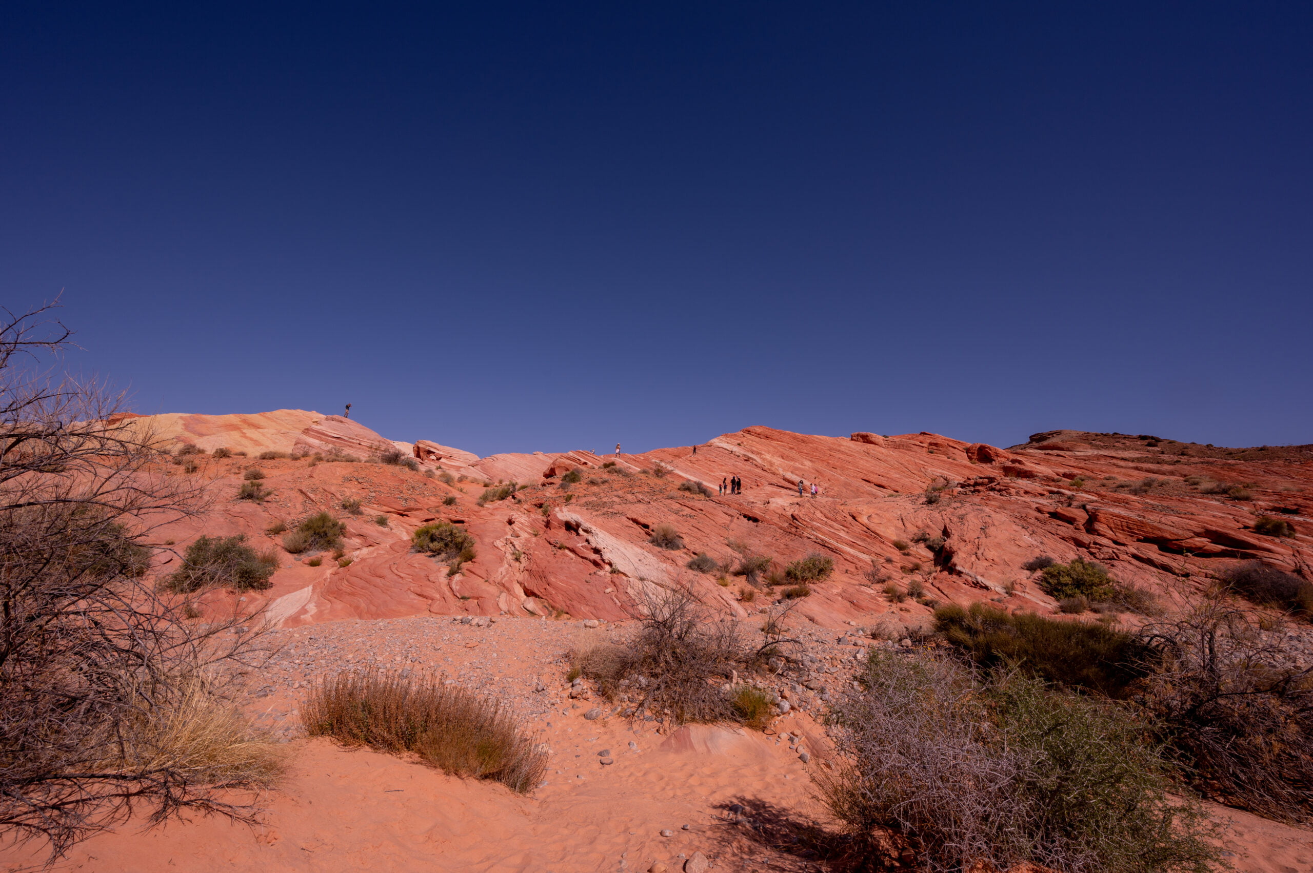
The start of the trail is on the far side of the gravel parking area. It is a sandy trail leading you toward these giant red rocks rising above the desert. This rock formation is a guide for you to know which side of the road the trail starts on and guide you on your return hike to the parking lot. The trail curves around to the right of the giant red formation, and you follow it down a hill before it curves back around and to the right. From this point on, it is pretty much a straight hike to the Fire Wave. 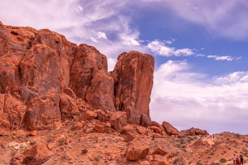 Follow the striped sandstone that makes up most of the trail. You’ll see a few trail markers scattered along this way, but mostly I looked for the direction other hikers were taking to keep me on track.
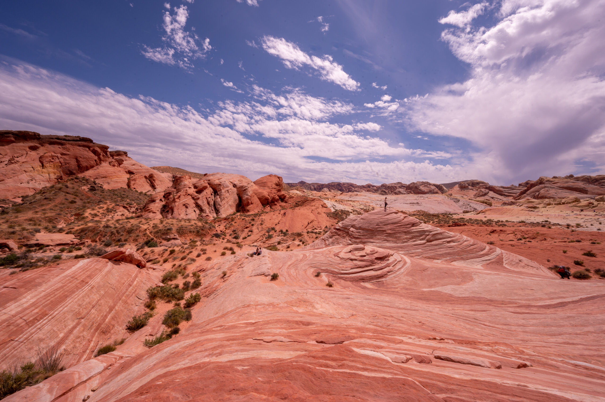
In about 20-minutes from the start of the trail, you’ll arrive at The Fire Wave. It is beautiful to see it sweeping before you and swirling around like a giant stone wave frozen in time. You can hike down onto the Fire Wave or climb to the top for a better vantage point. You’ll probably need to get in line to do this, but be patient, and you’ll get your chance. Most people come and find a place to sit along the wave, admiring this unique and beautiful landscape. The red, pink, and white hues pop against the blue sky. Most won’t stay too long as the sun is unrelenting here in the desert.
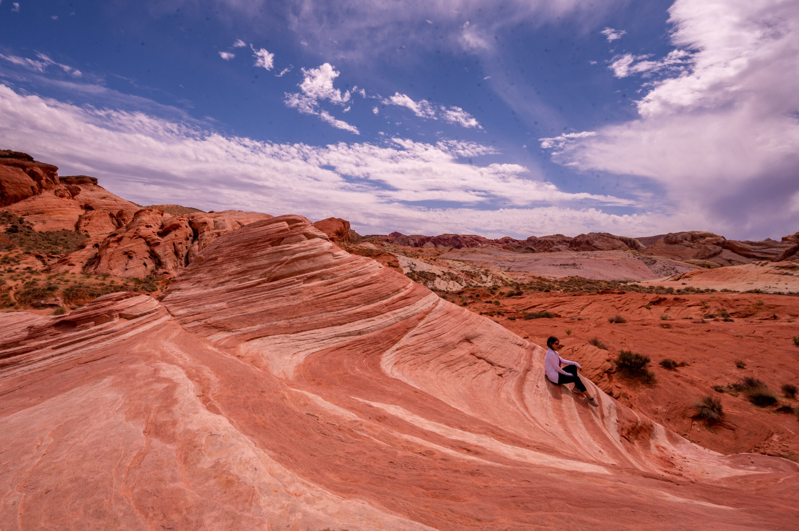
A hiker is taking a moment to sit on the right side of the Fire Wave.
One of the first views as you reach the edge of the Fire Wave.
Right-side view of the Fire Wave.
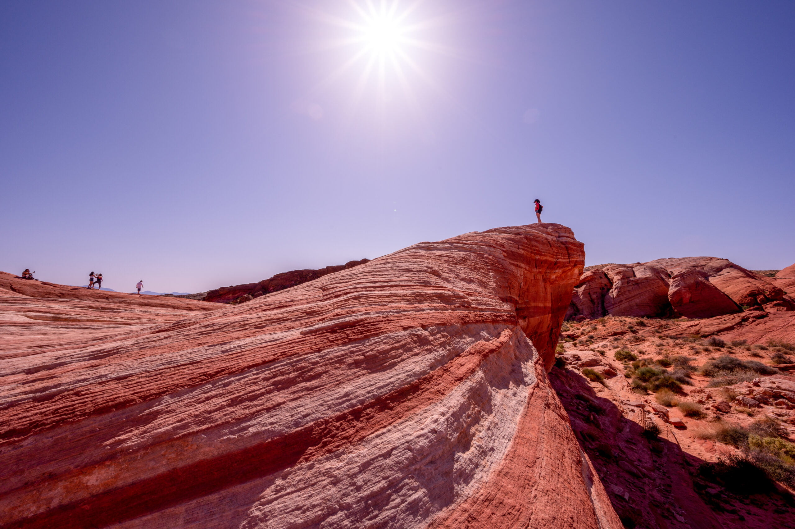
Climb a little higher for a sweeping view of the area.
Hydrate for the Return Hike
After enjoying the view and taking as many photo ops as you wish, head back toward those huge red rocks that mark the beginning of the trail. If you’re like me, you’ll be surprised at how hot it gets and how an easy hike quickly becomes more difficult due to the heat. Drink some water, and then drink some more! It’s that final ascent where you’ll need to push yourself, but then you can return to the air-conditioned car and continue to more gorgeous hikes during your day at Valley of Fire State Park. The Fire Wave is one of the most popular hikes, but make sure to take time for at least one more. My pick would be the White Domes Loop Trail.
Pastel Canyon - An Alternate Route to the Fire Wave
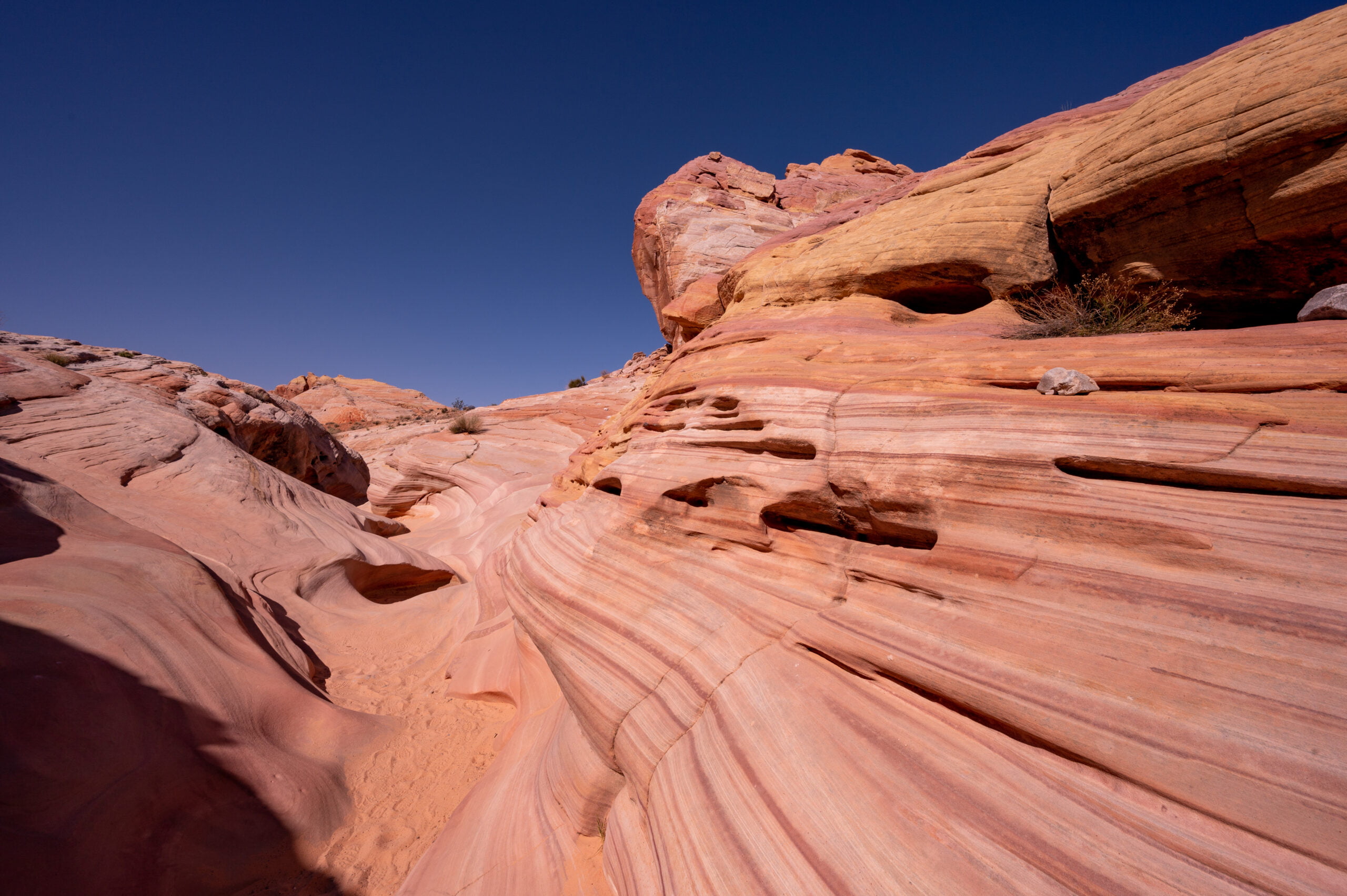
Although I think the main trailhead is the best way to hike to the Fire Wave, there is one other way you can reach it. I discovered it when I was hiking to the Pastel Canyon. This short, unmarked trail takes you through a small canyon with striped rocks colored in pastel pinks and yellows.
I love these rock veins, so interesting!
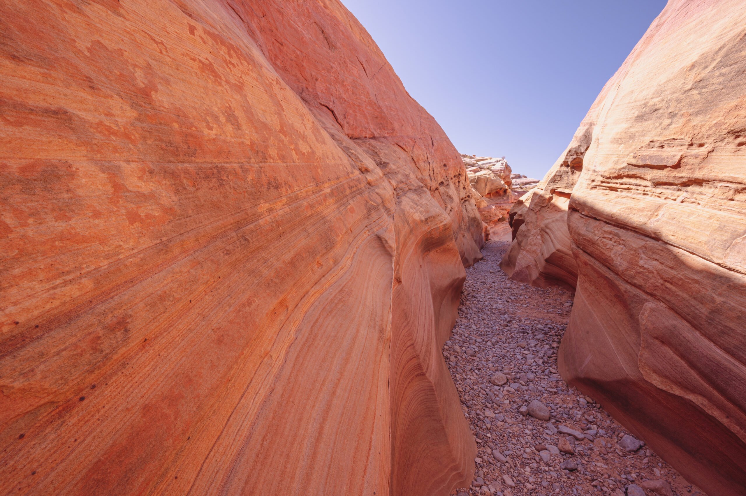
The small Pastel slot canyon.
Look at those beautiful stripes!
The wash at the end of the Pastel Canyon.
If you continue along the wash that winds through the small canyon, you’ll soon come to a bend where if you look to your left, you’ll most likely see people standing around on top of the Fire Wave! Yep, with only about a 10-minute walk from the road through the Pastel Canyon and wash, you will arrive on the opposite side of the Fire Wave. You can walk over and up the Fire Wave, where you’ll then see the large red rocks in the far distance that mark the start of the main trailhead.
If you can’t find parking at the Fire Wave trailhead or prefer the flattest and shortest route, you might look to see if there is any parking at the Pastel Canyon. Just note there is no official parking here, only a small pull-out big enough for around 5-6 cars. The Pastel Canyon is worth the quick stop, even if you don’t hike to the Fire Wave from here. It only takes about 10-minutes total to walk to the small canyon and admire its beautiful hues. There are no signs, though, so you’ll need to add it to your Google Maps. It is about 4 miles up the Mouse’s Tank Road and before you arrive at P3.
Final Thoughts on Planning Your Visit
There are no restaurants or food amenities inside Valley of Fire State Park. Make sure to plan ahead and bring lots of water, at least 1-gallon per person, for your day at Valley of Fire State Park. You will also want to bring snacks and a picnic lunch. Please read my article on how to plan the perfect day trip to Valley of Fire and get tips on camping here as well as other hikes to do. Have a “rocking” day! (Sorry just had to throw that pun in there.)
Note: This post contains affiliate links. When you make a purchase using one of these affiliate links, we get paid a small commission at no extra cost to you.

Written by
Charity
Traveler, coffee enthusiast, and storyteller — exploring destinations one sip at a time.
Share this story
Keep Reading
Keep Reading

More Adventures
Explore More
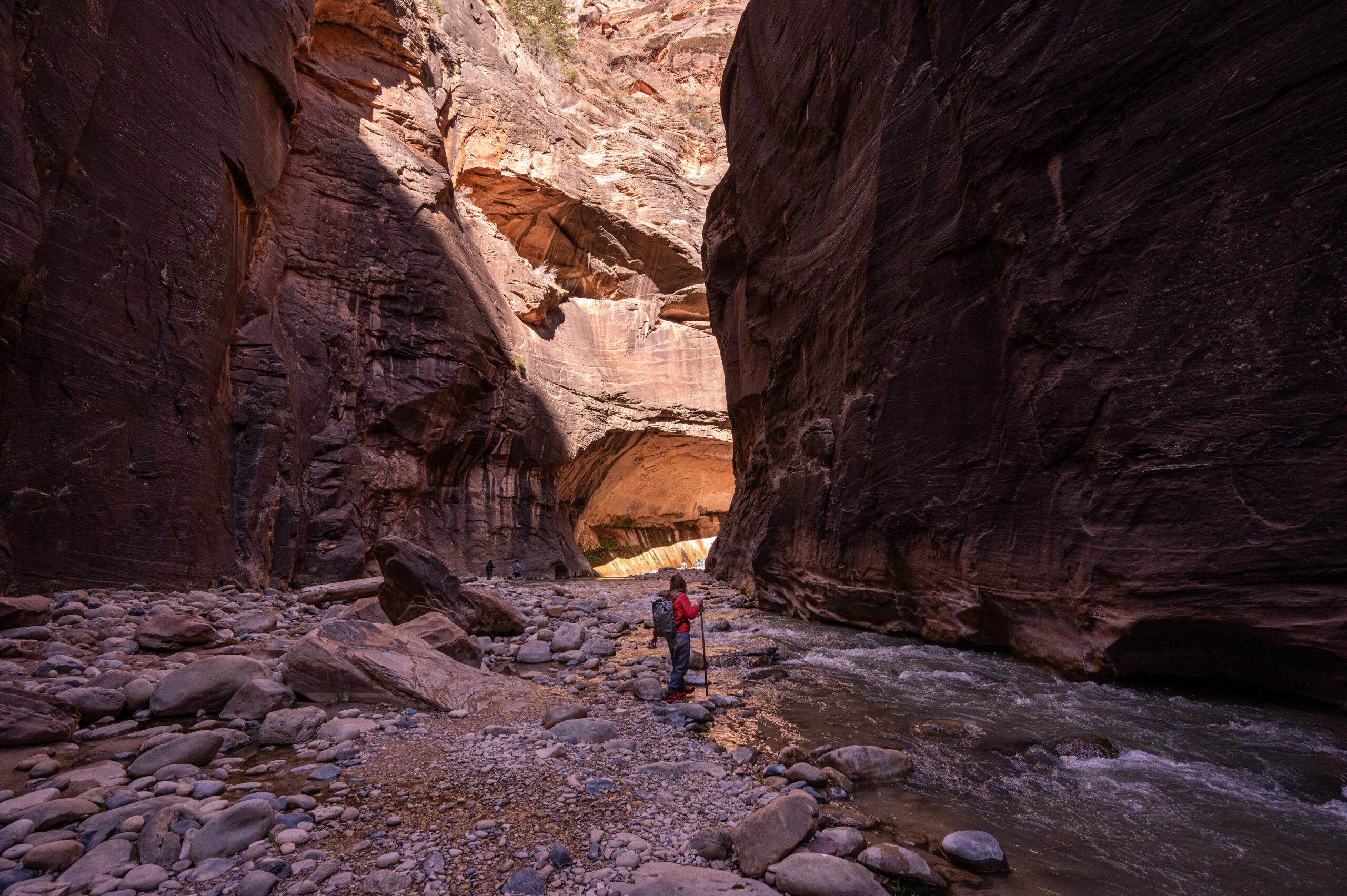
Hiking The Narrows in Spring at Zion National Park
Hiking The Narrows at Zion National Park is a unique experience you'll never forget. Learn how to plan your visit and what you'll need.
Read More
Exploring the New Gnome Trail in Maple Valley
Explore the site of the New Gnome Trail and have fun hunting for gnomes! This kid-friendly hike in Maple Valley, WA is sure to be a hit!
Read More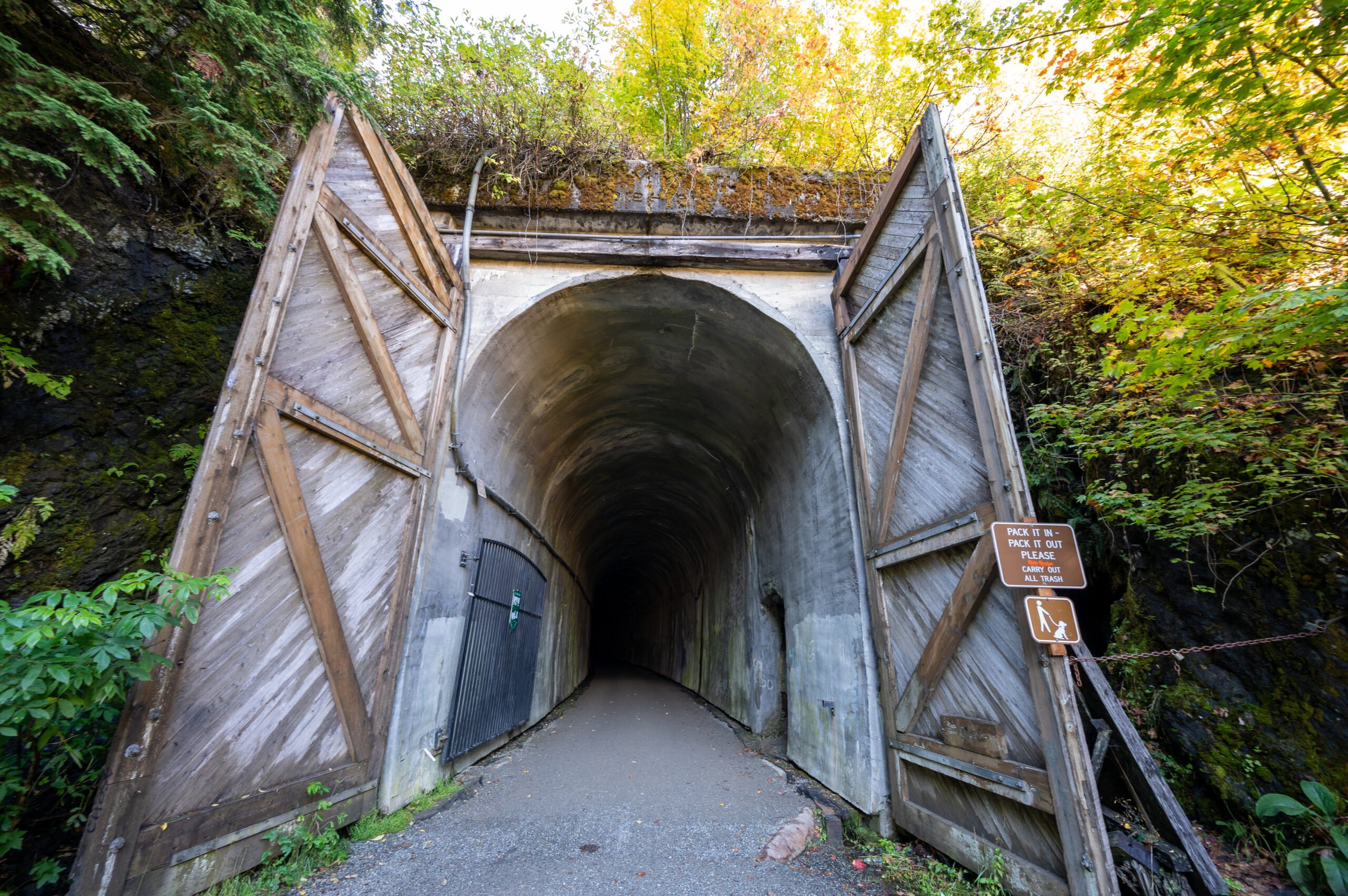
The Historic Snoqualmie Tunnel: A Spooky Adventure!
The Snoqualmie Tunnel trail is an adventure good for all ages! Walk through the darkness and experience a hike like no other!
Read More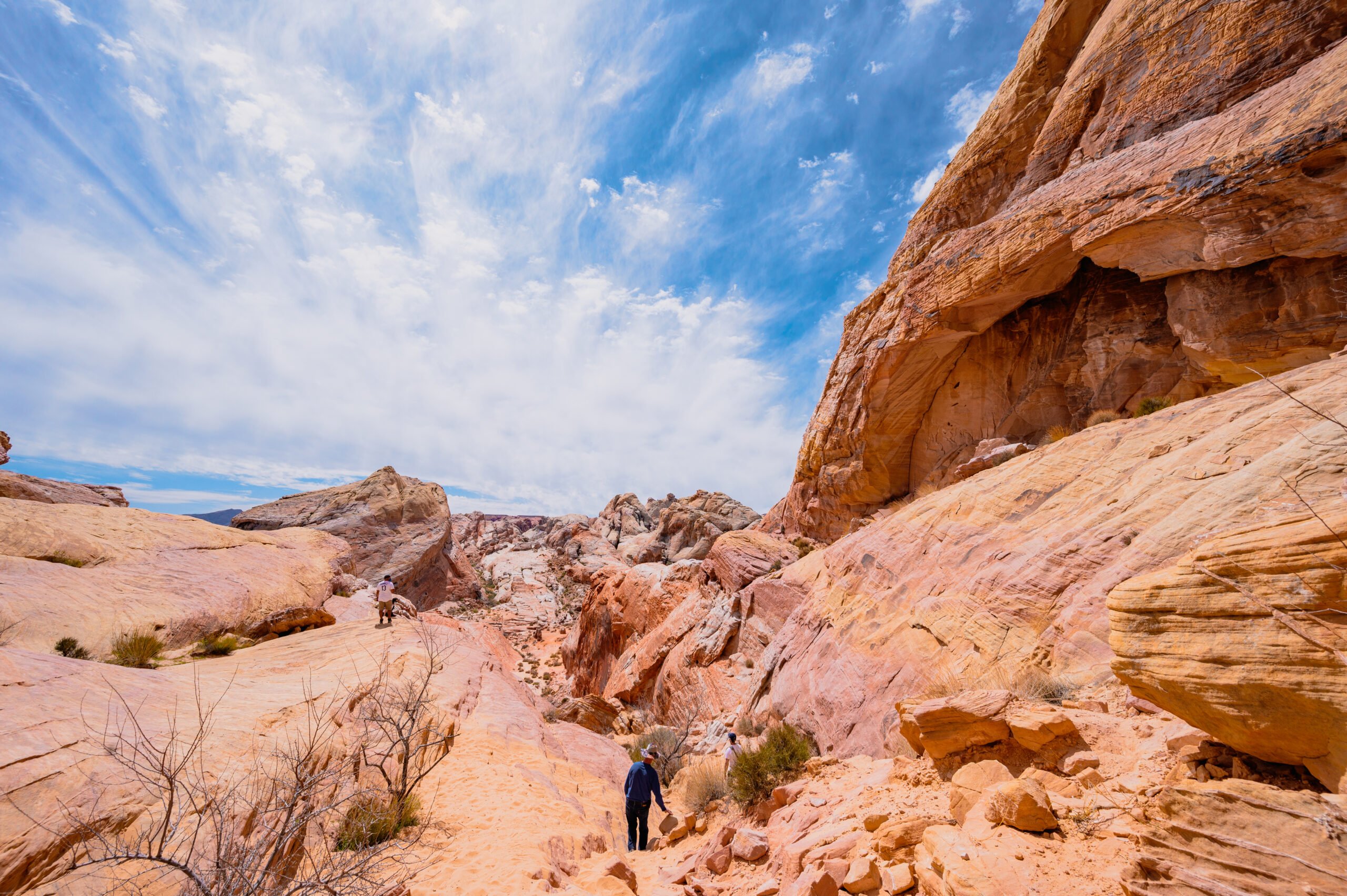
Valley of Fire State Park: A Perfect Day Trip From Las Vegas
Valley of Fire State Park is about an hour from Las Vegas. See gorgeous red and pink rocks, mountain sheep, and more at this beautiful park!
Read MoreRecent Posts

Keep Reading
You Might Also Like
- Hiking
Hiking The Narrows in Spring at Zion National Park
Hiking The Narrows at Zion National Park is a unique experience you'll never forget. Learn how to plan your visit and what you'll need.
Read more - Hiking
Exploring the New Gnome Trail in Maple Valley
Explore the site of the New Gnome Trail and have fun hunting for gnomes! This kid-friendly hike in Maple Valley, WA is sure to be a hit!
Read more - Hiking
The Historic Snoqualmie Tunnel: A Spooky Adventure!
The Snoqualmie Tunnel trail is an adventure good for all ages! Walk through the darkness and experience a hike like no other!
Read more