
**Update** The Gnomes Trail has relocated to 25719 Maple Valley Black Diamond Rd SE, Maple Valley, WA 98038. This is also the parking area for the Maple Valley Farmers Market. Read my updated post on the NEW Gnome Trail here.
Share on facebook Facebook Share on pinterest Pinterest Share on reddit Reddit Share on twitter Twitter Share on email Email If you’re looking for a fun, family-friendly hike, then look no further than the Gnomes Trail in Maple Valley, WA. Explore this whimsical trail located within Henry’s Ridge Open Space. Henry’s Ridge Open Space is a network of trails that extend within the Maple Valley and Ravensdale areas. The Gnomes Trail is an easy 2-mile roundtrip hike suitable for all ages. The trail is mostly flat and has a very mild elevation gain of only about 150 feet. I saw people of all ages and fitness levels hiking this trail. So if you are new to hiking or have younger kids, the Gnomes Trail is a great place to start.
Getting to the Gnomes Trail
There are two starting points for the Gnomes Trail in Maple Valley.
- 279th Street Park: Maple Ridge Way SE, Maple Valley, WA 98038
- Henry’s Ridge Open Space: 253rd PI SE, Maple Valley, WA 98038
I chose to start my hike at the 279th Street Park. However, you can also start the hike from the Henry’s Ridge Open Space trailhead off of SE 281st Way and 253rd Place SE. Click on the map and see the two trailhead parking areas as well as the mapped trail routes. I recommend downloading the Google Map for offline use before leaving for your hike. Google Maps will give you walking directions from whichever parking area you choose to start the hike. Google Maps displays the trail and shows you which path to take. You can refer to the map all along the way to make sure you’re on the right track.
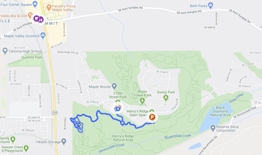
Parking for the Gnomes Trail
Whether you choose to start from the 279th Street Park or Henry’s Ridge Open Space, just know that there is only street parking at both trailheads. I found the 279th Street Park to have less traffic and more parking areas than at the trailhead for Henry’s Ridge Open Space. You can always go to one, and if you can’t find parking, then try the next trailhead. Refer to the above map for directions.
Sharing the Trail
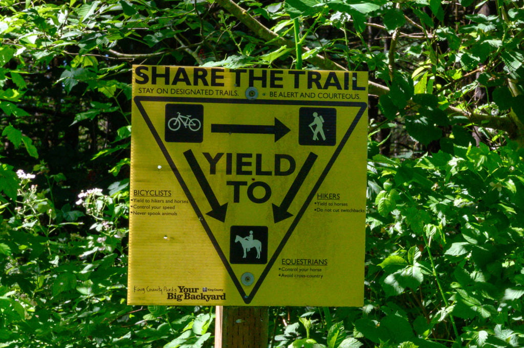 The Henry Ridge Open Space is a multi-use trail system. This means that you are sharing the trails within this natural space with bicyclists, horses, and other hikers. So yield to horses and move over for the bicyclists. I know the sign says bicyclists should yield to both hikers and horses, yet, I find as a hiker it is easiest for me to move out of the way.
Hiking the Gnomes Trail in Maple Valley, WA
I started my hike from the 279th Street Park, but if you choose to start from the Henry Ridge Open Space trailhead, the directions are the same once you reach the Once Upon a Time trail. It’s important to note that not all of the trails are clearly labeled, so use this guide to help you navigate. Additionally, download an offline map from Google Maps for directions before leaving home.
Starting from the Henry Ridge Open Space Trailhead
You’ll access the trailhead next to the road and continue straight (pass the Old Mike trail) until you reach the Stinger trail where you’ll make a right. Follow Stinger until you reach a wide gravel trail, this is Route 66, turn right on to the path. In about 20 feet, you’ll cross the road and make a left onto the Once Upon a Time trail (OUAT). From here the directions are the same as if you were starting from the 279th Street Park.
Starting from the 279th Street Park
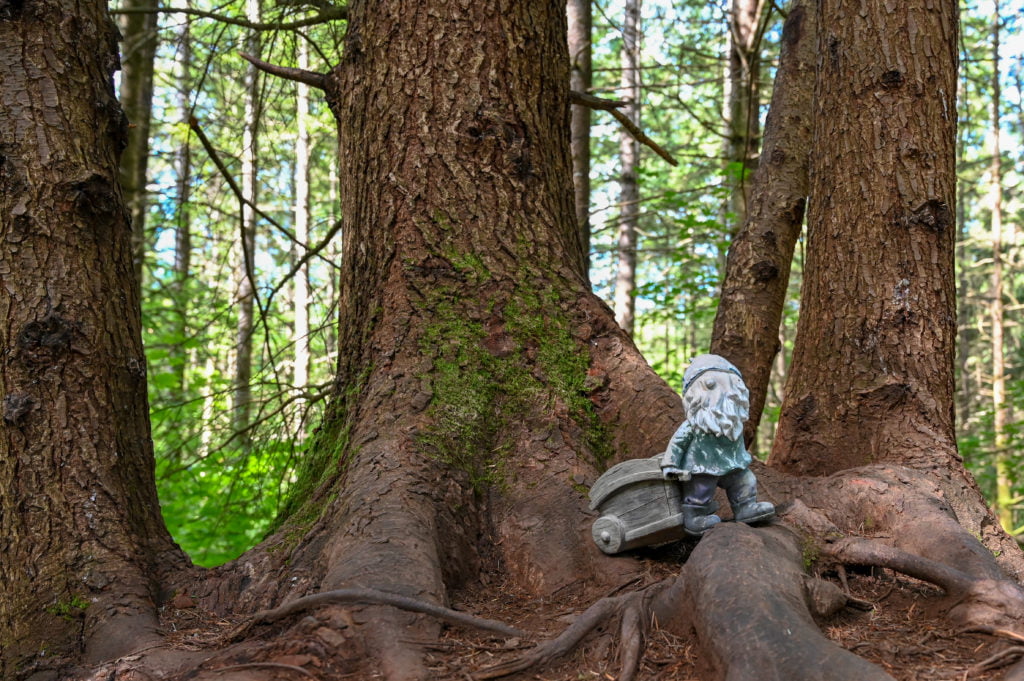
Park alongside the 279th Street Park and then cross the road to the trailhead. This gravel path is called Route 66 on the map. Follow Route 66 for less than a quarter-mile before making a sharp right onto the Once Upon a Time trail (OUAT). You’ll spot your first gnome shortly after starting this trail. I think he’s there to let you know you’re heading the right way.
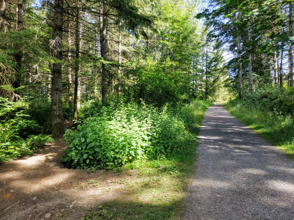
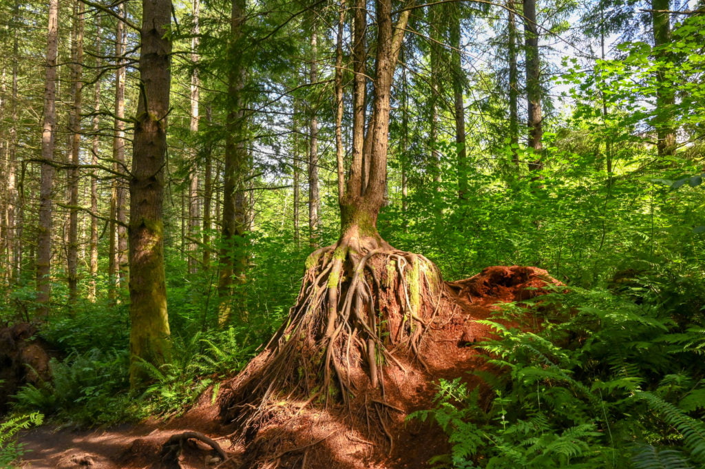
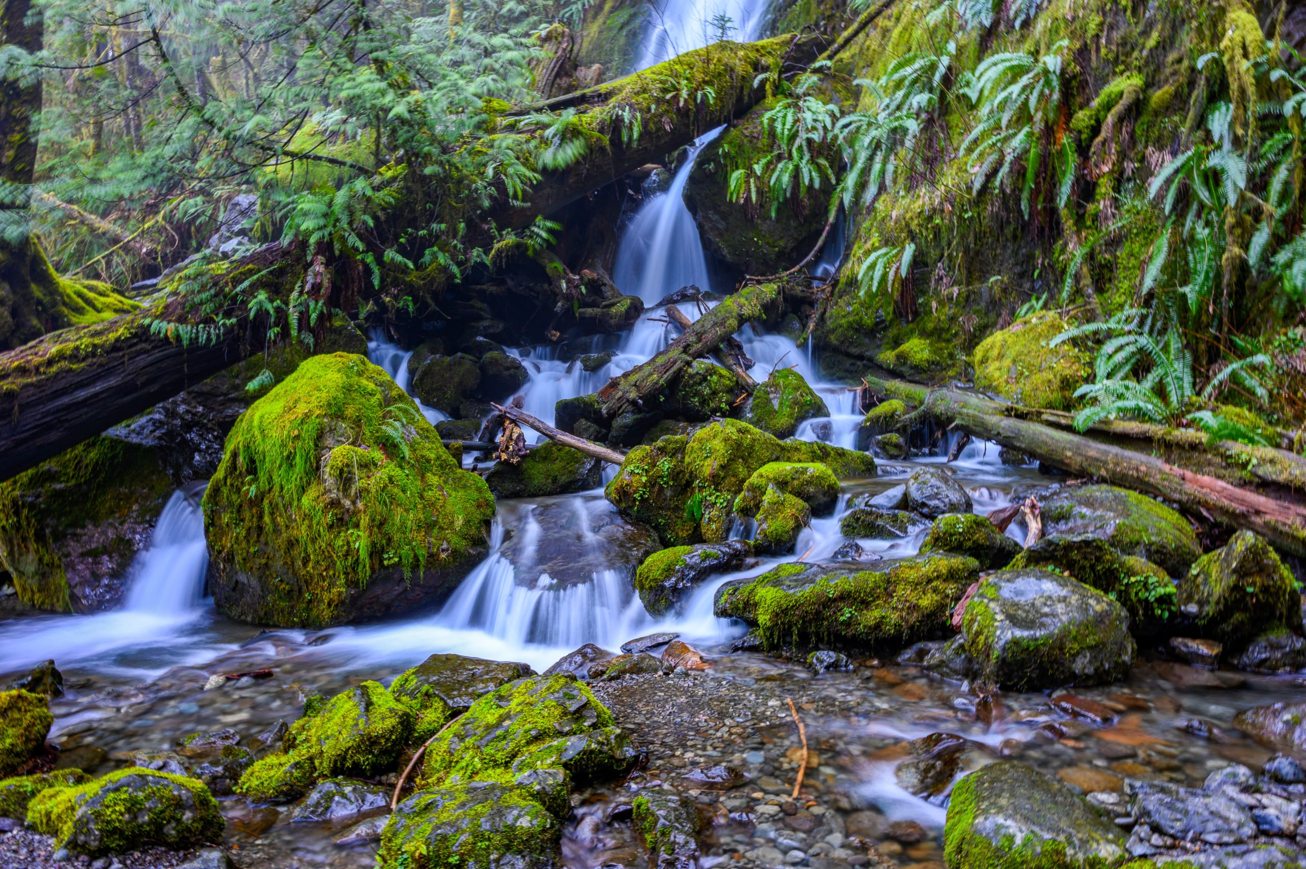
This portion of the hike is a dirt trail with rocks and roots here and there, but ample space to stop on the side to let people pass when needed. Enjoy the forest with its moss-covered trees and stumps left from larger trees that once grew there.
The Derailer Trail and Two Choices
Eventually, you’ll come to a fork in the path, and if you look right, you’ll see a diamond-shaped sign and a sign above it that reads “Derailer.” You can go right or left here.
- If you go right on the Derailer trail, you will follow the path as it loops around and links up with the Lorax trail. Make a right onto the Lorax trail. (Skip to the asterisk (*) past the directions for making a left to continue.) (The instructions from that point on are the same whether you make a right or left at the Derailer fork.)
- If you go left at the fork where you see the Derailer trail sign, you will continue a short way down the trail before reaching another fork in the path. Make a right here to continue on the OUAT trail (Bad Wolf is to the left). In about 250 feet you’ll make another slight right onto the Lorax trail (I don’t recall seeing a sign). You’ll continue down the Lorax trail and soon pass the fork for the Derailer loop, just stay to the left.
*Continue along the trail, and soon you reach a footbridge made out of a fallen tree. There are two bridges, I stuck with the larger one on the left, but both link you back to the same trail. Cross the bridge and follow the path as it curves left; shortly up ahead, you’ll see the welcome sign for the Gnomes trail. 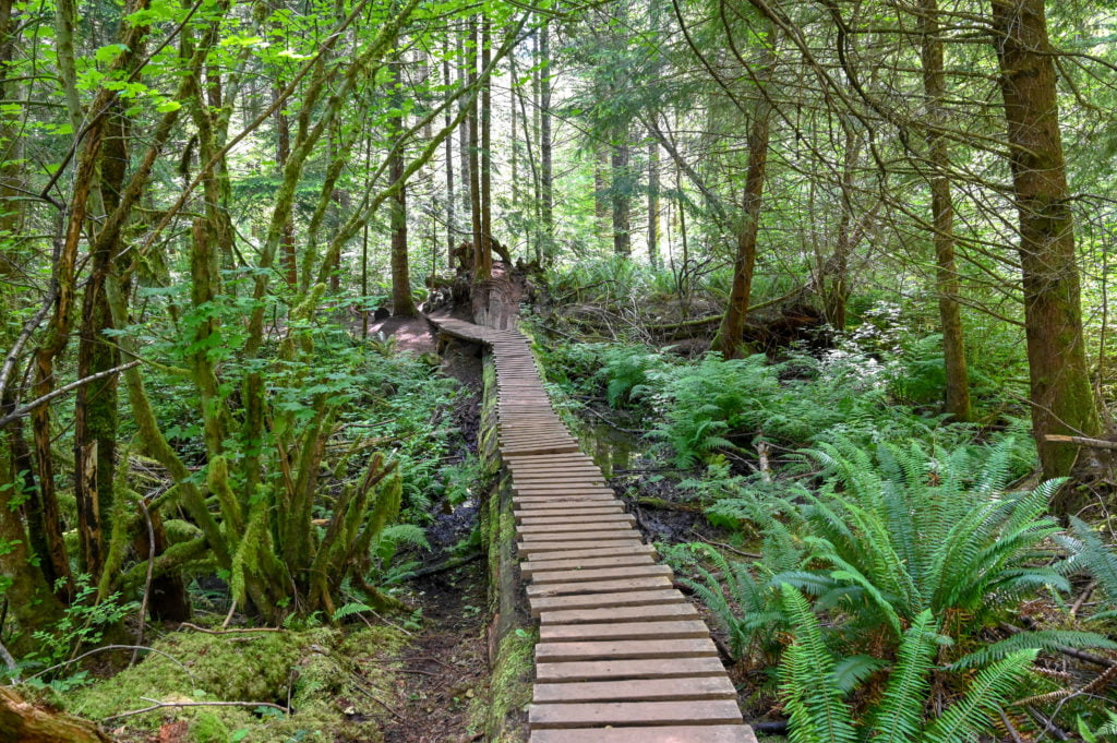
The Gnomes Trail
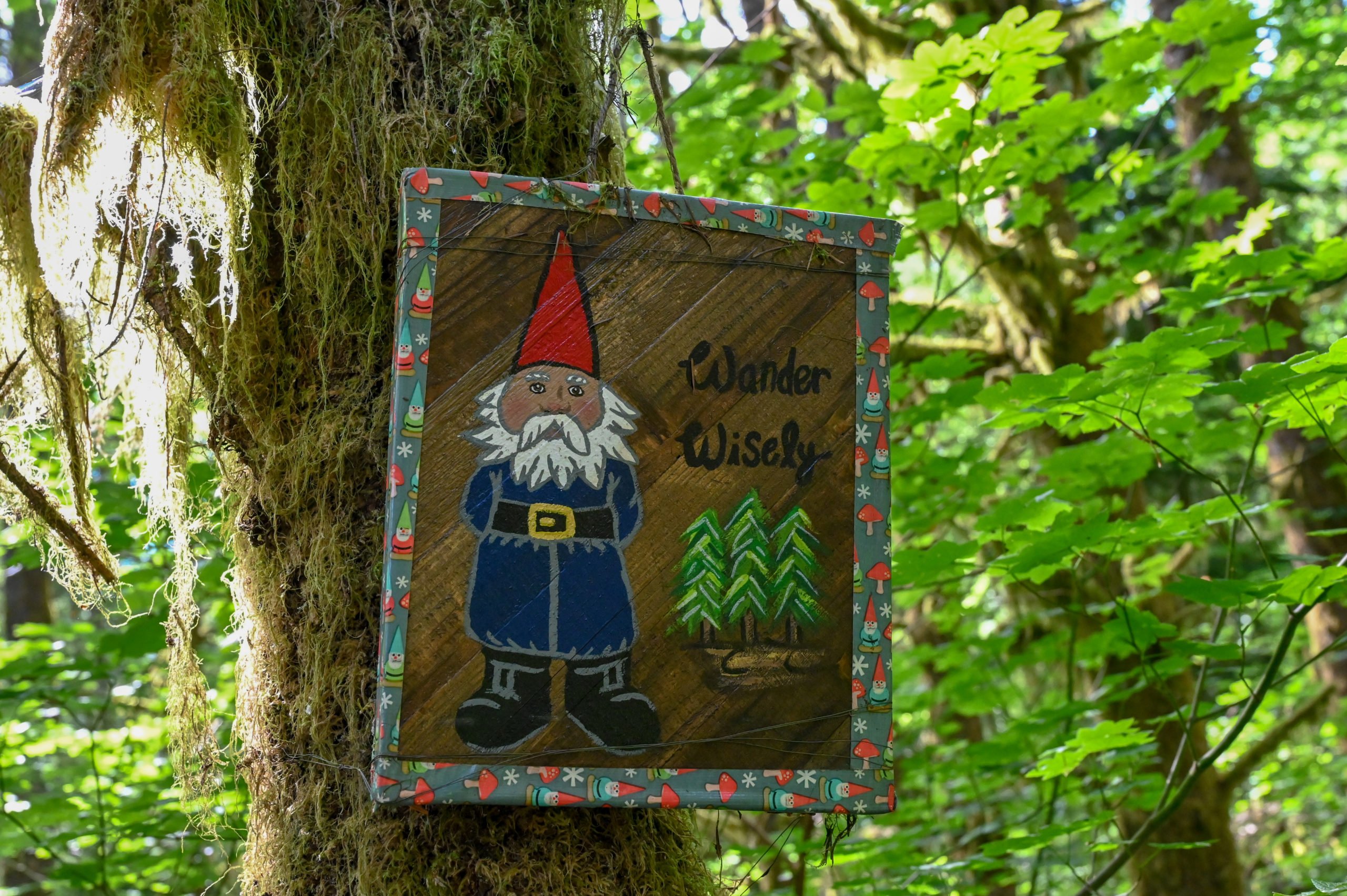
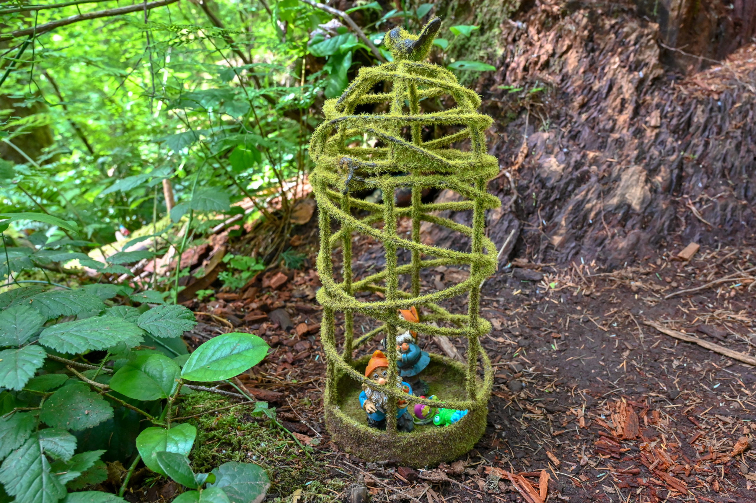
Take the Gnomes trail on the right and stay right to follow the trail’s loop. The Gnomes trail loop is around 0.5 miles. At the entrance to the Gnomes trail, you’ll find a welcome area and a trailhead sign. Continue up the path enjoying the gnomes scattered everywhere. Make sure to look up in the trees and under shrubs. You could make it a game for the kids to see how many gnomes they can find. Speaking of games, there is also a geocache hidden not too far from the entrance to the Gnomes trail. If you’ve never been geocaching, it is a lot of fun for kids and adults alike! You can download the app and look up geocaches near you to find more. Click on the photos below to view a larger image. These are some of the signs that greet you near the entrance of the trail.
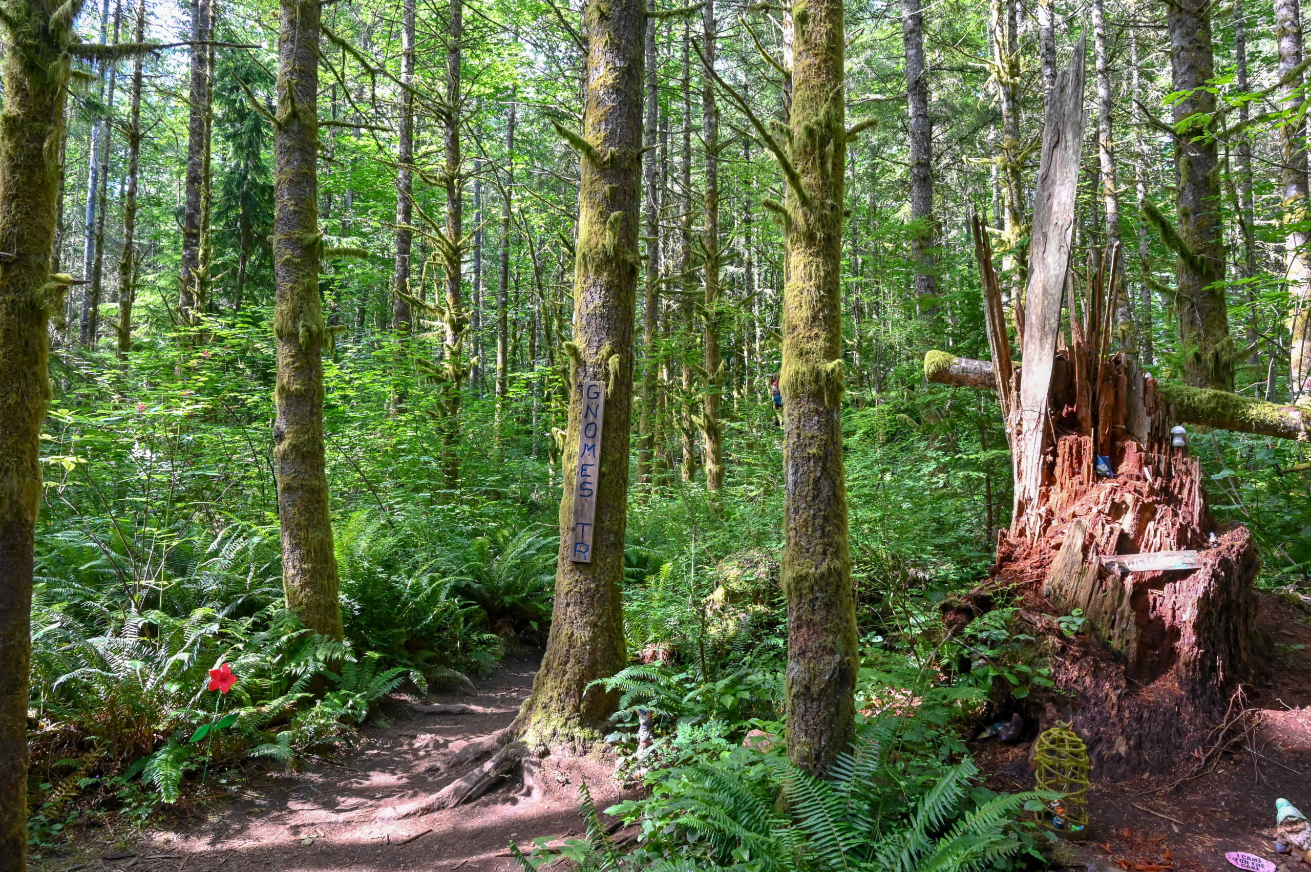
The entrance to the Gnome trail.
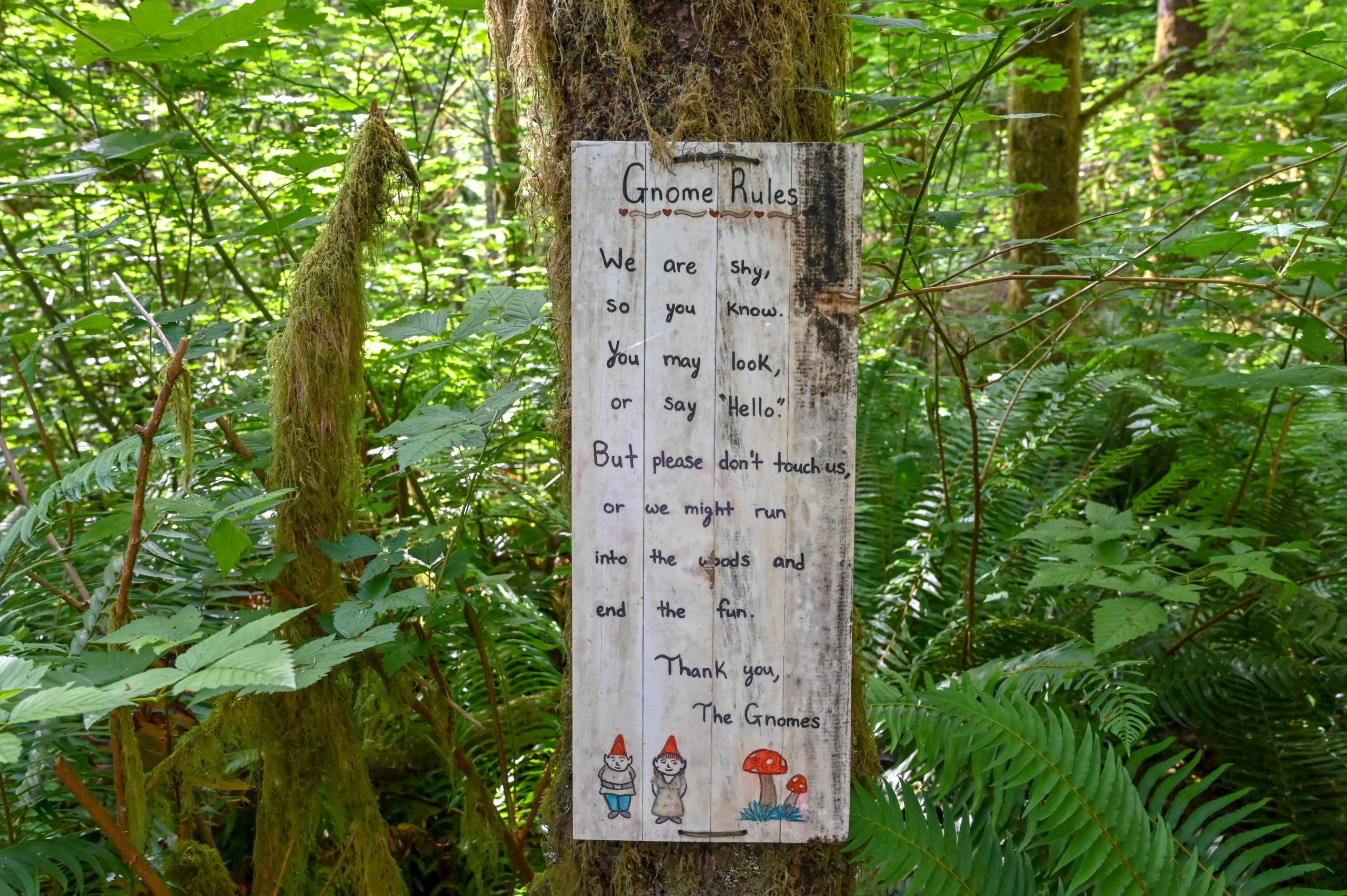
A cute sign about Gnome rules.
This is another sign near the entrance of the Gnome trail.
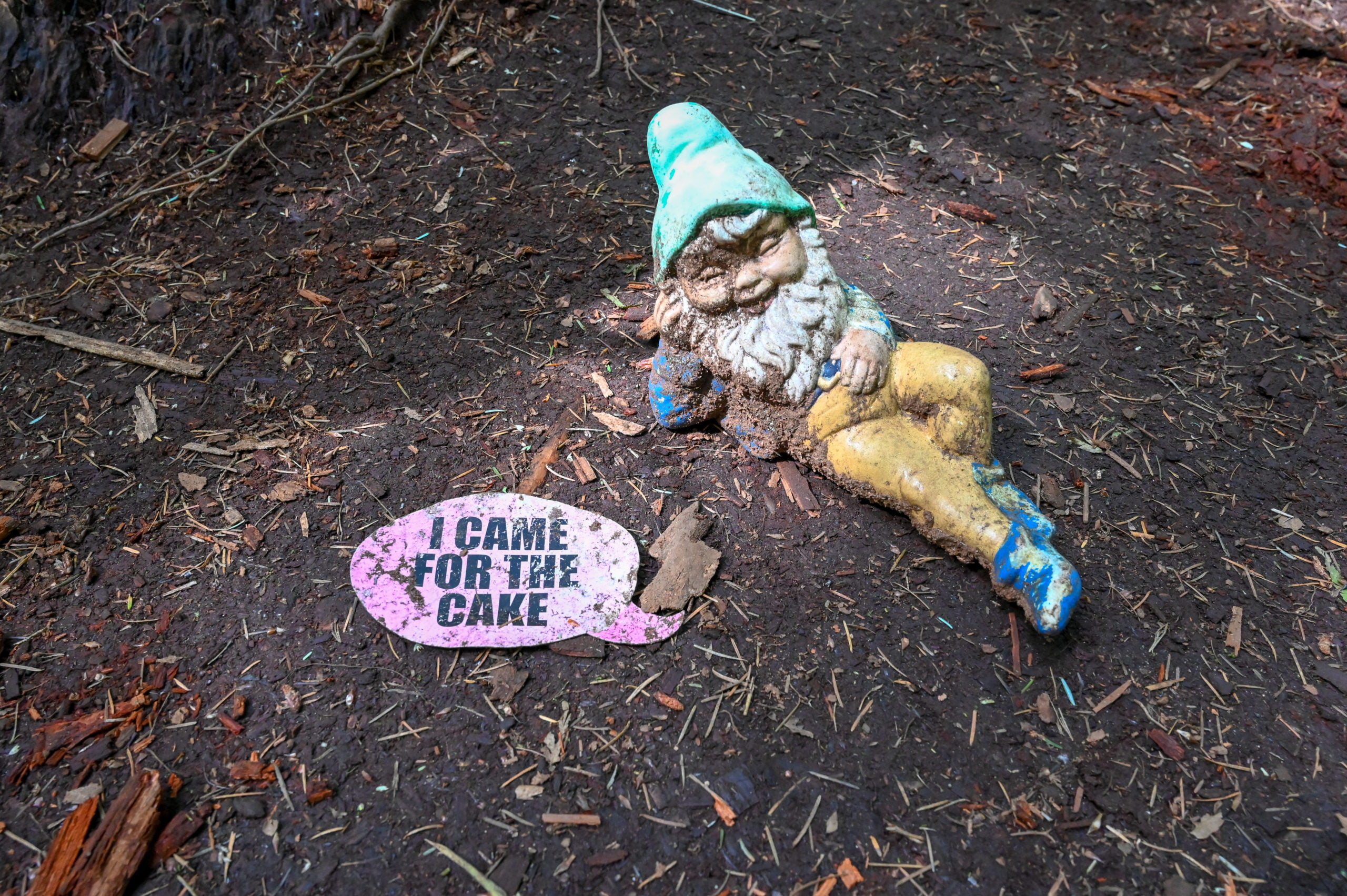
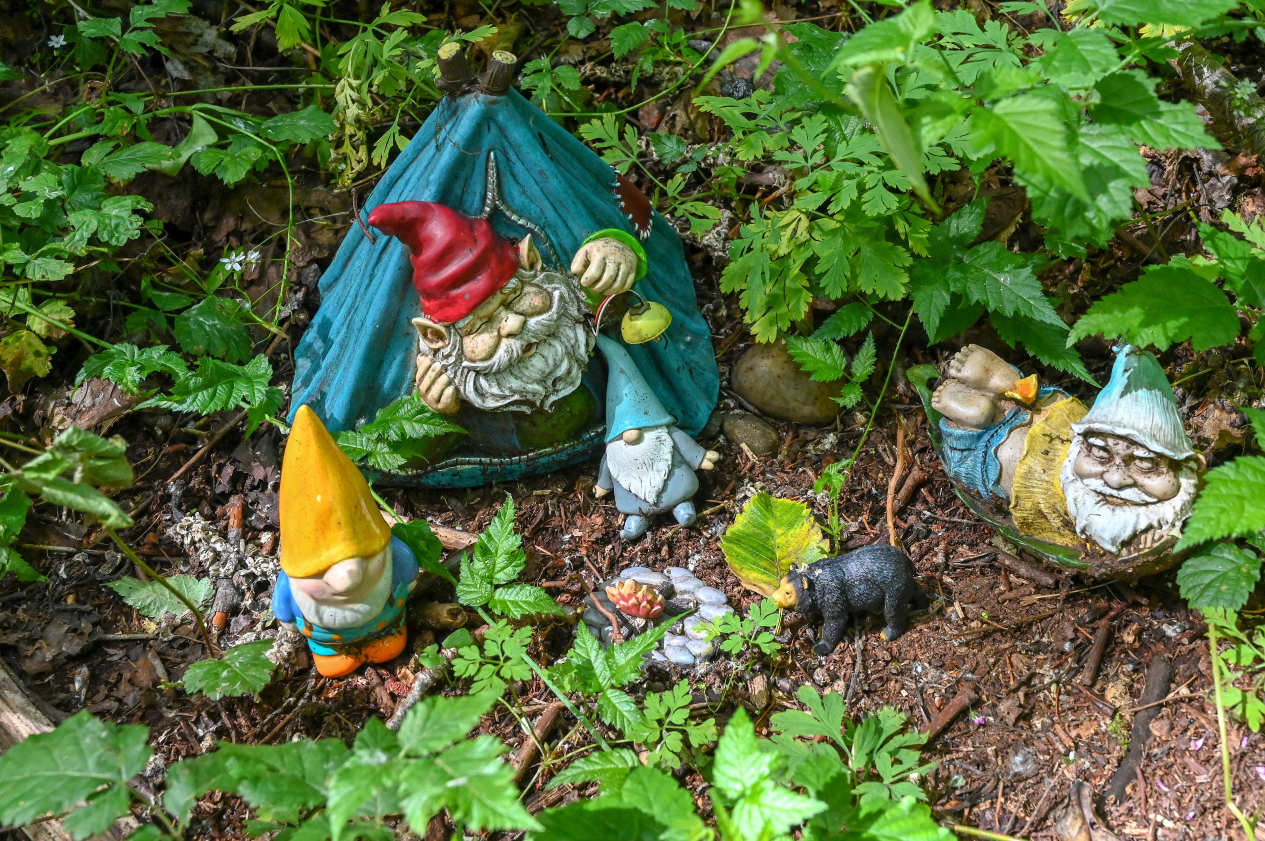
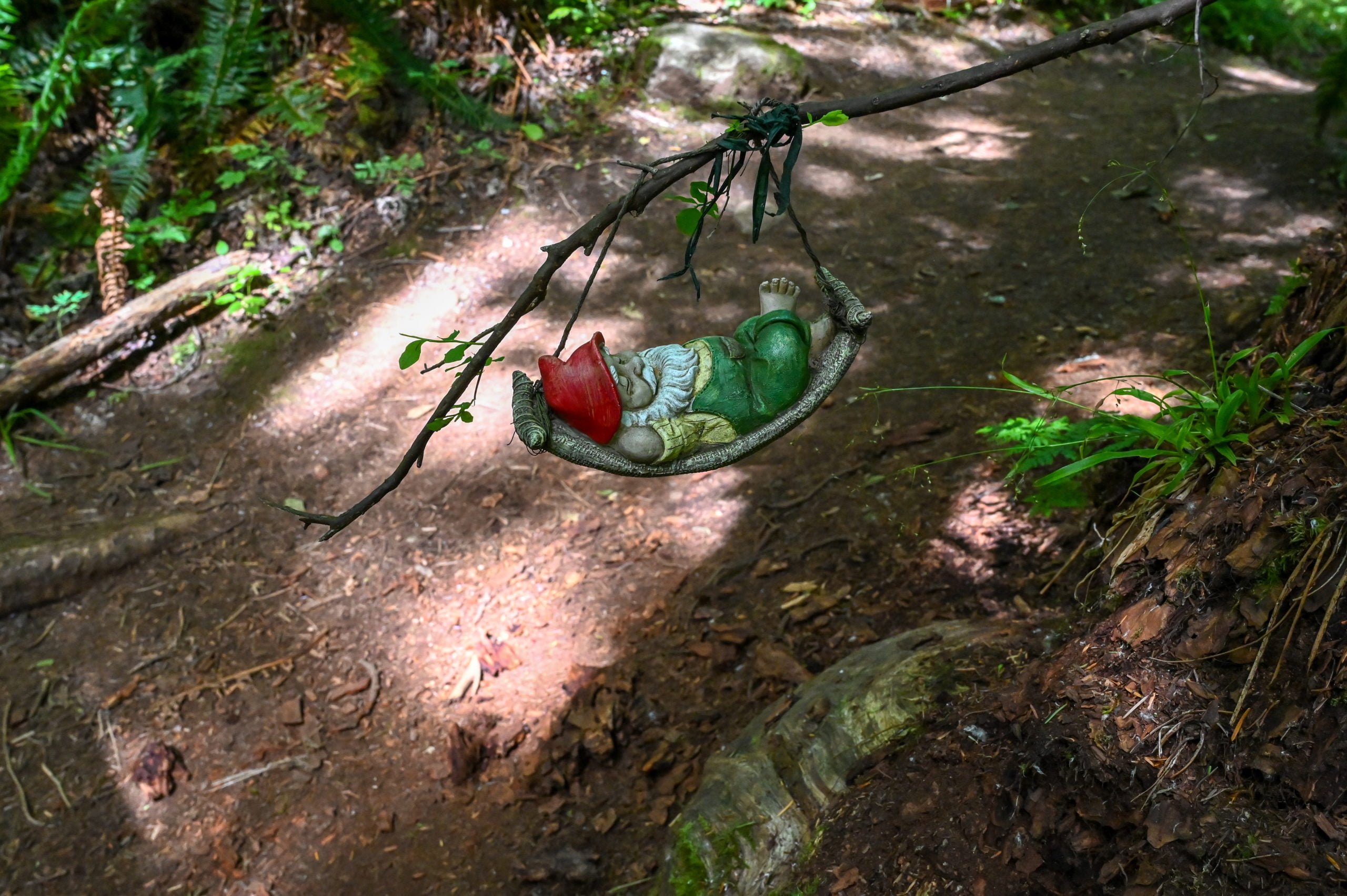
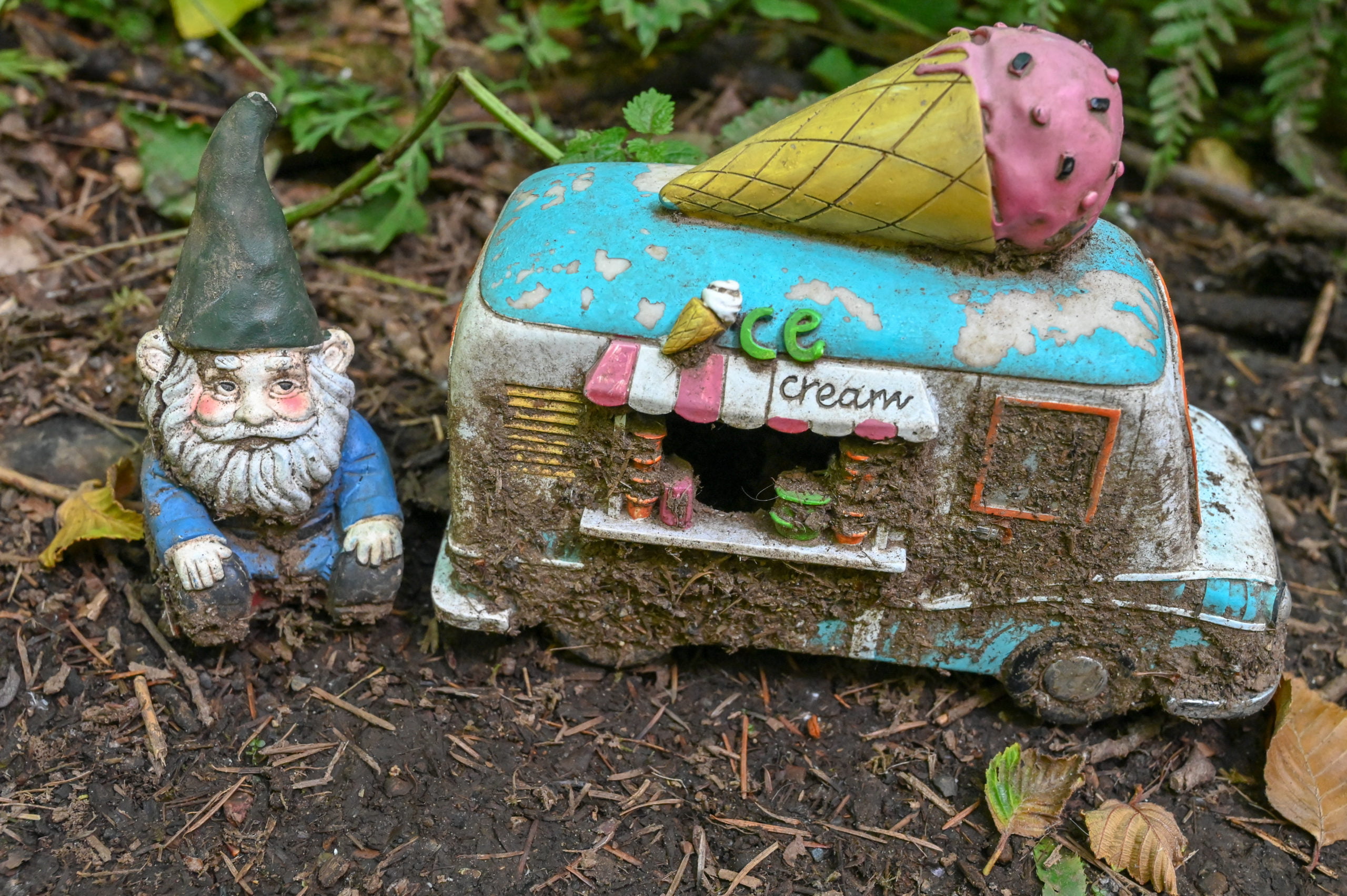
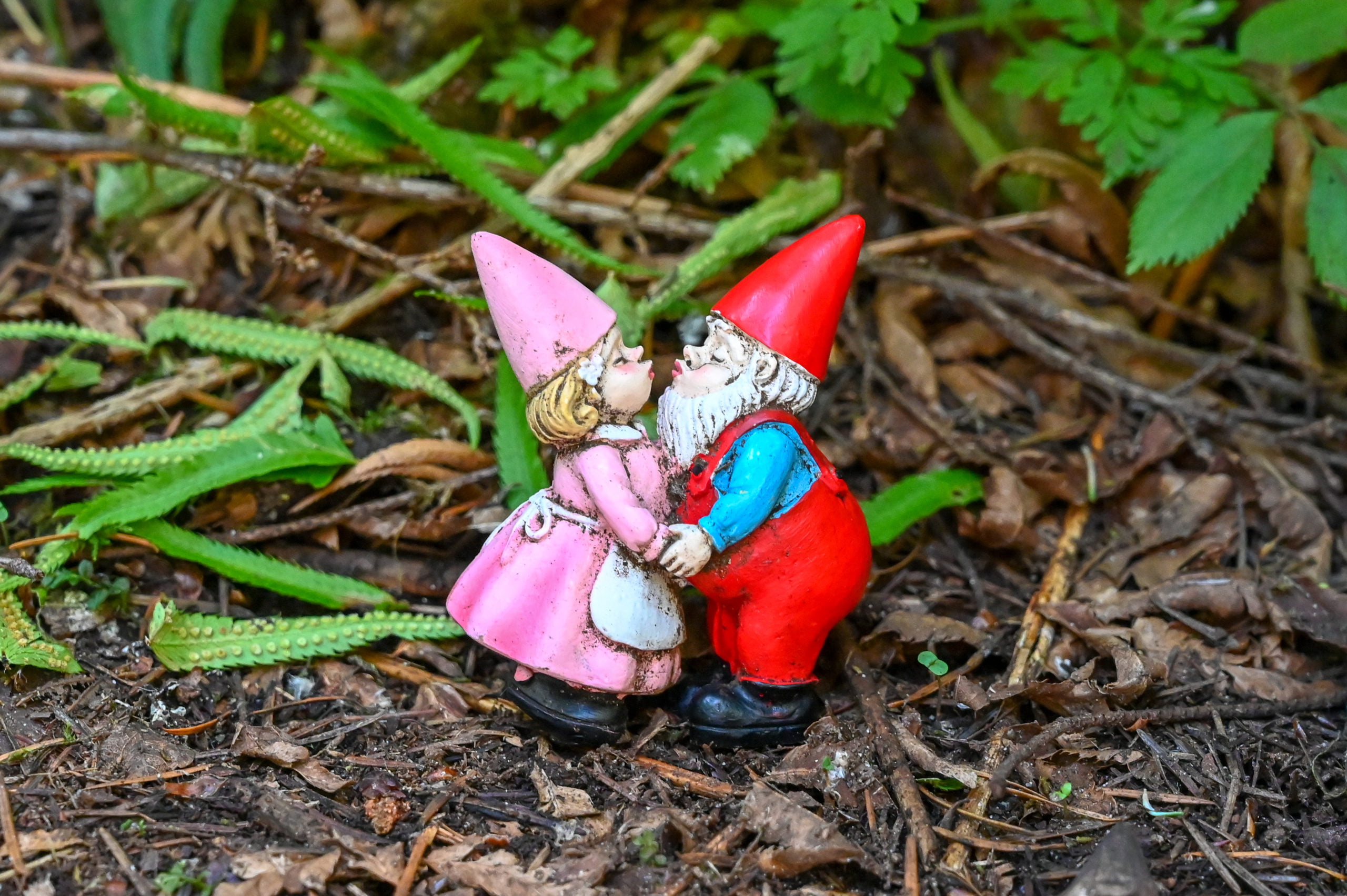
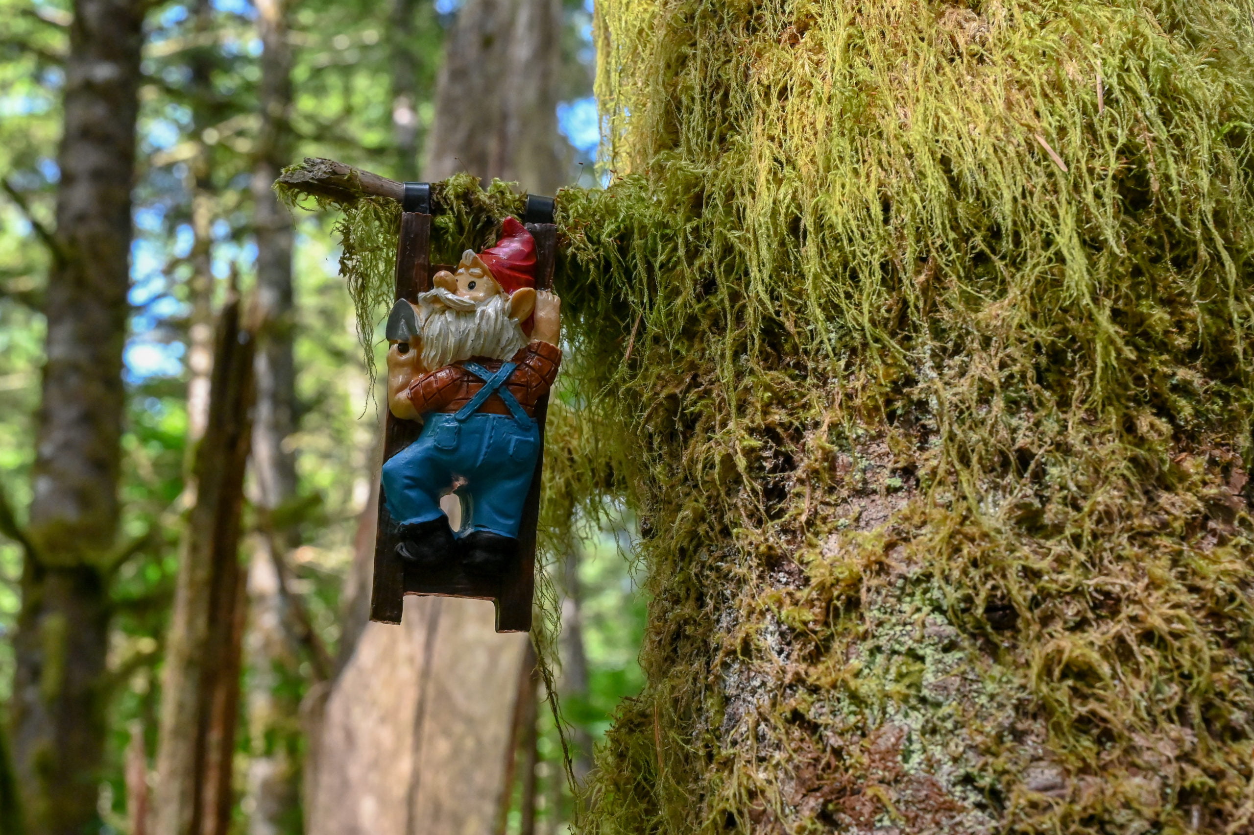
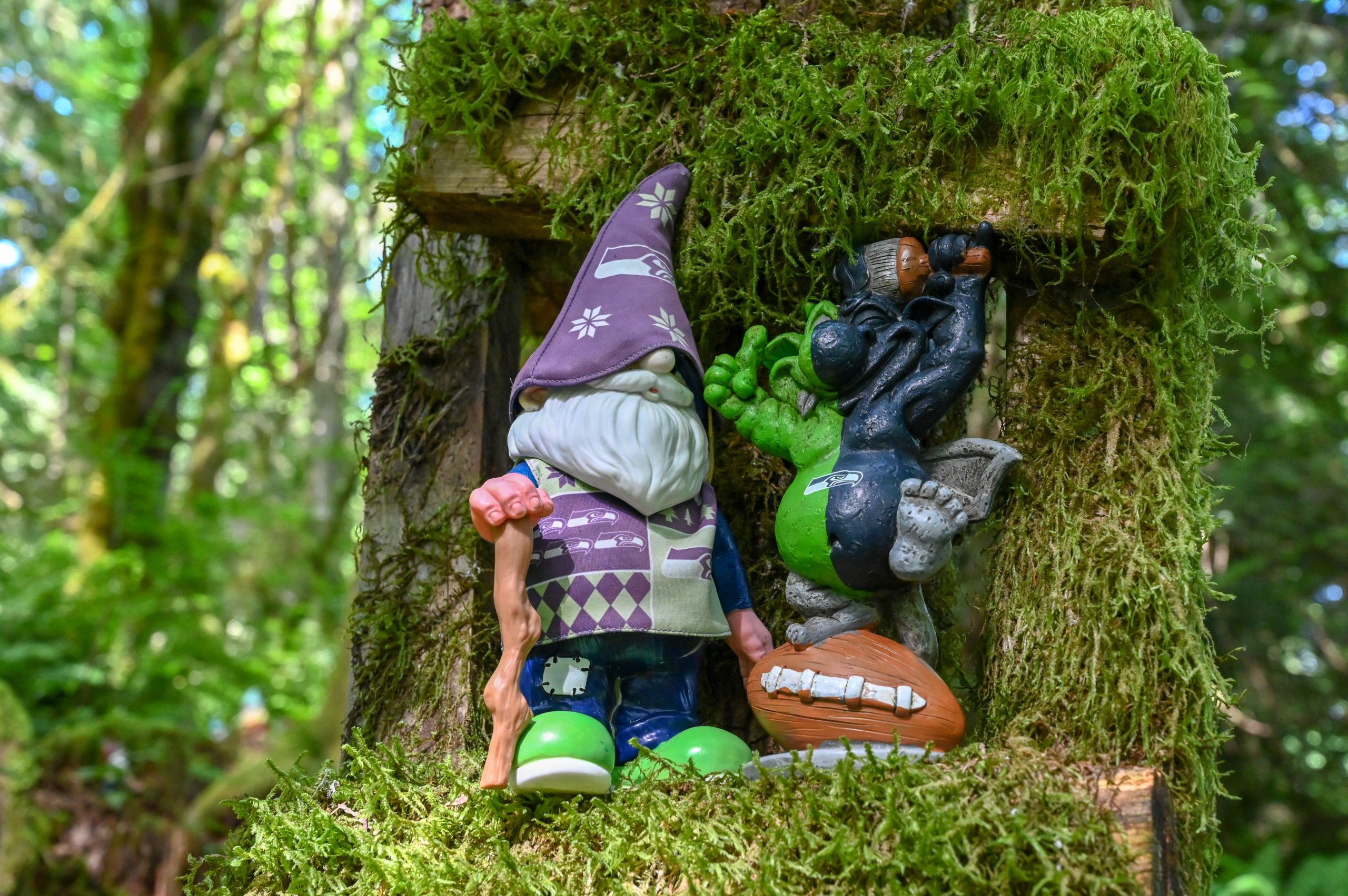
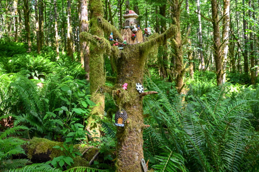
The Gnomes trail loop is a series of switchbacks curving right and left and then right and left again as it winds its way up, and then down, and then back up before looping you down and around to the main entrance of the Gnomes trail. You see a huge variety of gnomes in the first part of the trail, there are even a few fairies, dwarfs, and I also spotted a troll. The gnomes appear to enjoy many of the same activities we do, such as camping, sports, gardening, and so on. You’ll have fun spotting all the unique gnomes along the way. Here are some of the ones I found during my hike. Make sure to visit and discover your favorites too!
After the first series of switchbacks, you find yourself back near the main entrance, however, the trail curves right here and begins climbing up again. The gnomes will appear less and less as you continue along this portion of the trail. You’ll pass another trail junction, make sure to stay left, and soon you’ll come to a “T” in the path where you’ll make a left onto what is called the Ogre trail. Soon you’ll see a fork on the right for the Ogre trail but continue straight and don’t turn right where you see the sign that reads “Ogre.” You’re looping back, so you’ll want to stay left, and soon you will be back at the main entrance to the Gnomes trail. From this point on, you backtrack the way you came to return to your parking spot.
Useful Information to Know
- There are no restrooms at either the parking areas/trailheads or anywhere along the trail. So make sure to take a pitstop before you come.
- The hike is a little over 2 miles roundtrip, and it took me a little over an hour to hike it. If you have small kids or a large group, plan for it to take 1.5 to 2 hours for the roundtrip hike.
- The Gnomes trail is an easy hike with minimal elevation gain, but it is narrow in spots with rocks and roots and overgrown bushes along the way. So wear the appropriate shoes, and if you have any mobility issues, you may want to bring a hiking stick.
- The trail is too narrow in most spots to accommodate a stroller, so plan accordingly.
- Dogs are allowed, but make sure to pack your poo out as there are no garbages along the trail. This goes for all trash. This trail system is within a neighborhood, and we must be respectful of the community and the trails.
- Bring bug spray! The mosquitos were quite bad on the trails, and I sadly forgot to apply bug spray before leaving.
- Download an offline map through Google maps of the area, and Google can give you walking directions for the trail. You can also use any favorite maps apps you might have, such as AllTrails or BackCountry Navigator, if you want to track your hike.
- The Henry’s Ridge Open Space trails are designed in loops. So don’t panic if you do take a wrong path as it will link up with another one. There are multiple ways to get to the Gnomes Trail. I am only sharing a couple of options.
Recommendations for a Post Hike Treat
If you’d like something refreshing after your hike, why not head to Dairy Queen for a delicious ice cream treat or perhaps go through Gravity Coffee’s drive-through for a little pick-me-up for the ride home. I’ve marked both of these on the map at the beginning of this post. There are a ton of other options for food in the Maple Valley/Four Corners area if you want to grab a bite to eat. Dairy Queen 23924 SE Kent Kangley Rd, Maple Valley, WA 98038 Gravity Coffee 23912 SE Kent Kangley Rd, Maple Valley, WA 98038 I’d love to hear from you if you have hiked the Gnomes trail and what you thought about it. If you have any questions, please feel free to send me an email or post them in the comments section below.
For more hikes in Washington read the following posts:
- 6 Stunning Hikes in the Quinault Rainforest
- Hiking the Naches Peak Trail at Mt Rainier
- Snoqualmie Falls: A Short Walk to a Beautiful View
Happy Trails!

Written by
Charity
Traveler, coffee enthusiast, and storyteller — exploring destinations one sip at a time.
Share this story
Keep Reading
Keep Reading
More Adventures
Explore More
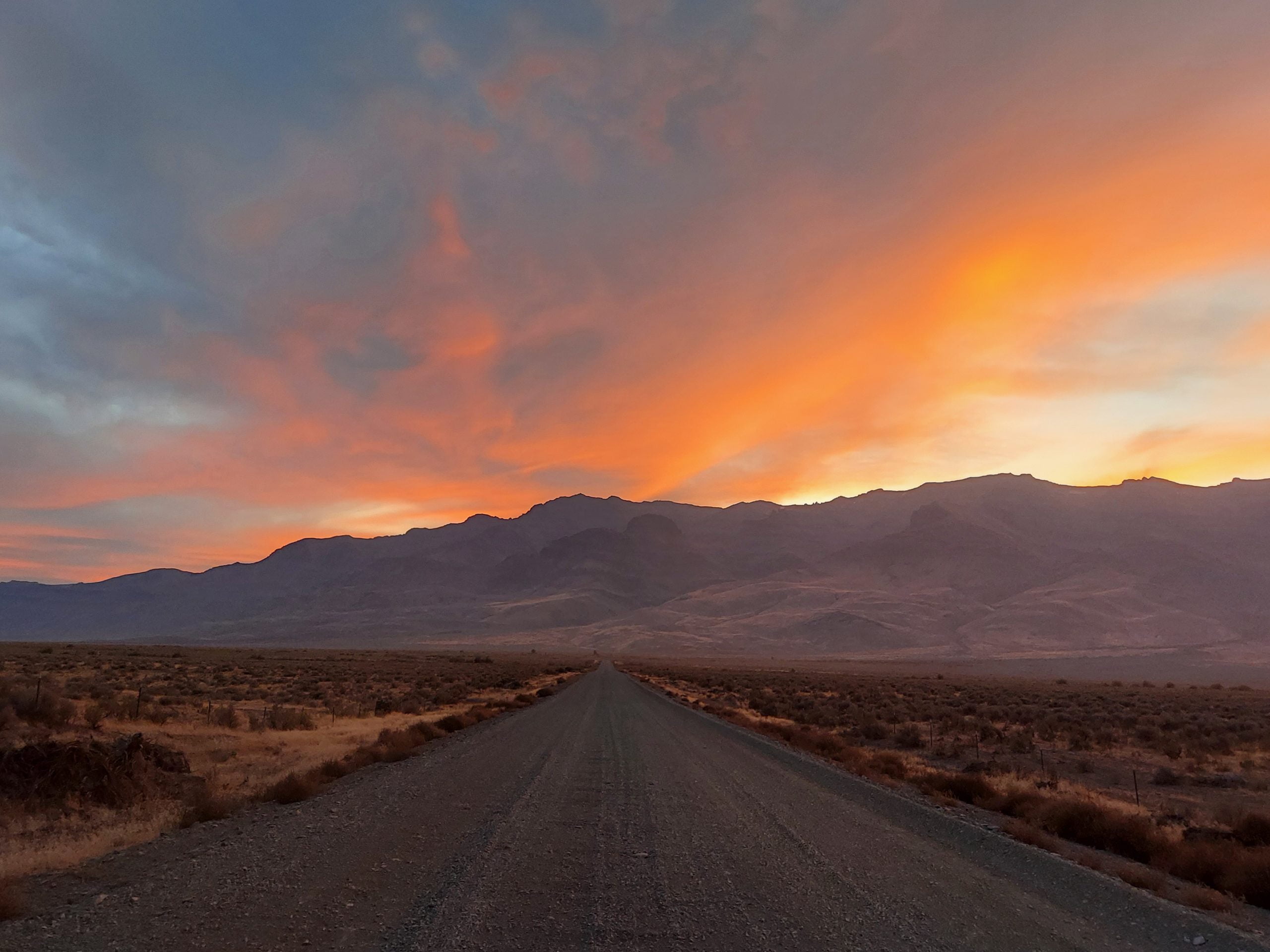
An Incredible One Week Oregon Road Trip
This Oregon road trip itinerary covers some of the remote and rugged areas of Oregon. Discover its natural beauty and unique landscapes.
Read More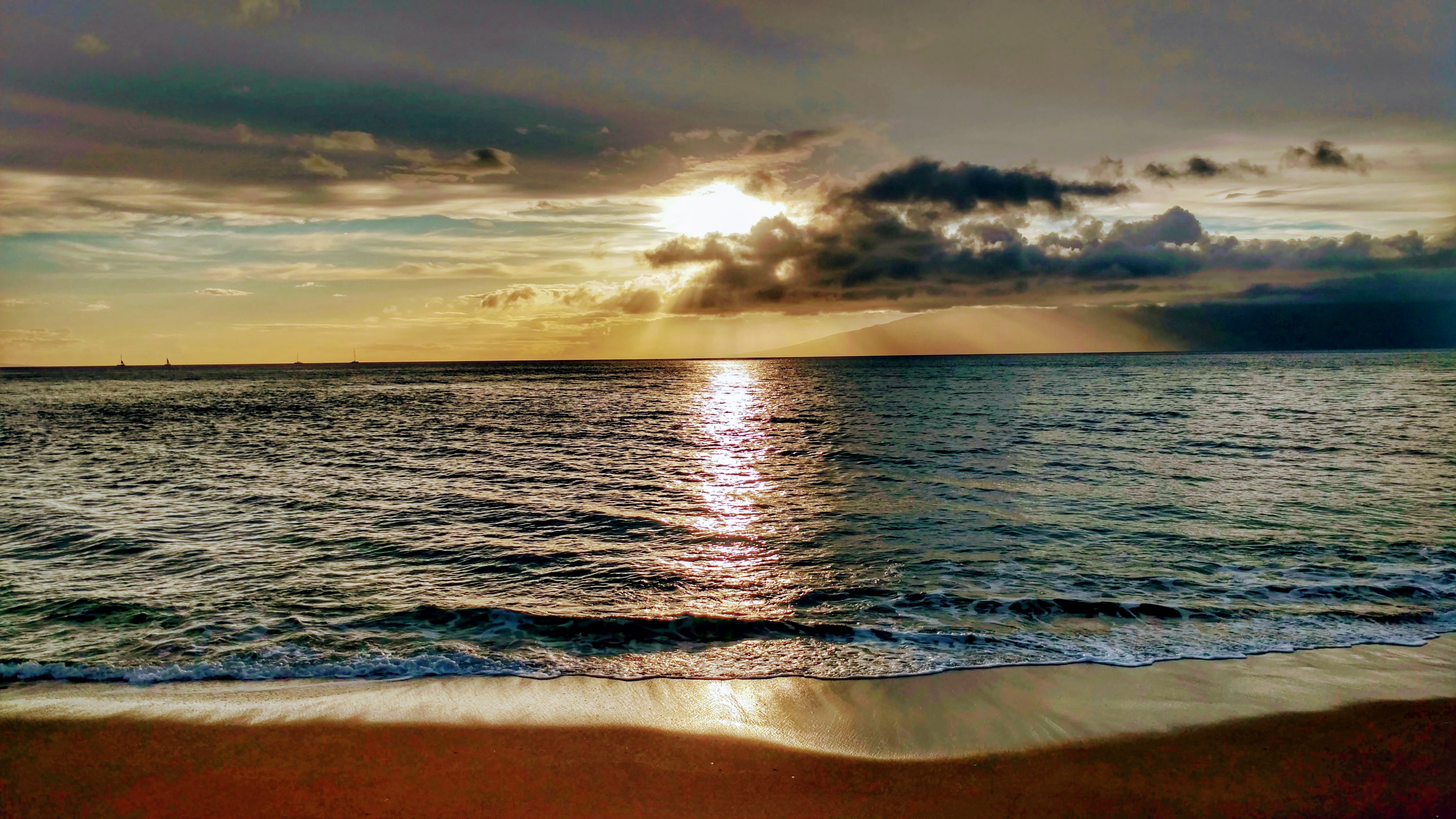
Best Maui Beaches for Snorkeling and Swimming
Here are the best Maui beaches for both snorkeling and swimming. Whether you're looking to sunbathe, snorkel, or body surf, we've got you covered!
Read More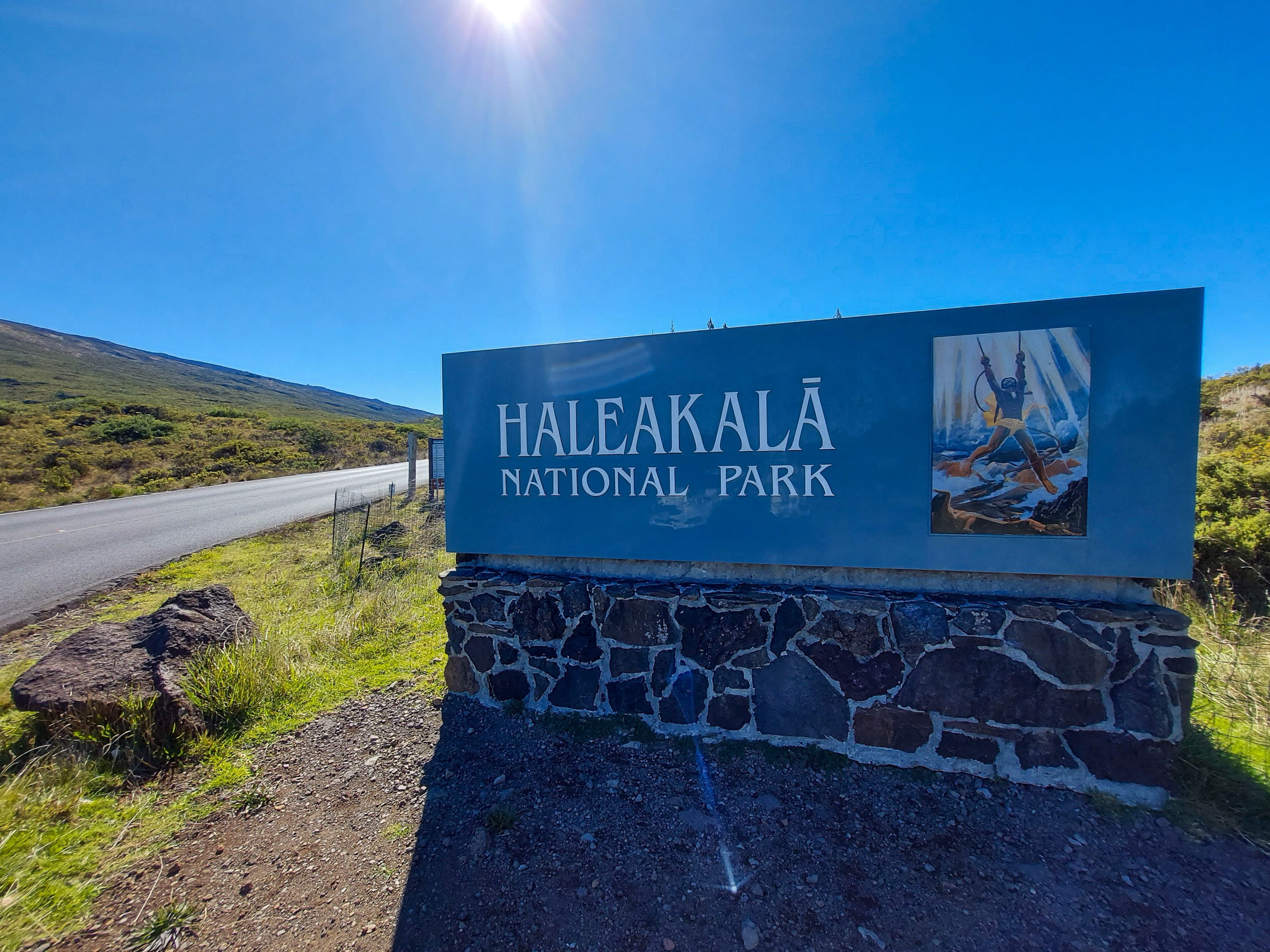
An Amazing Day Trip to Haleakala National Park
Spend an amazing day at Haleakala National Park. Enjoy driving through Maui's Upcountry and then high above the clouds to Halekala's summit.
Read More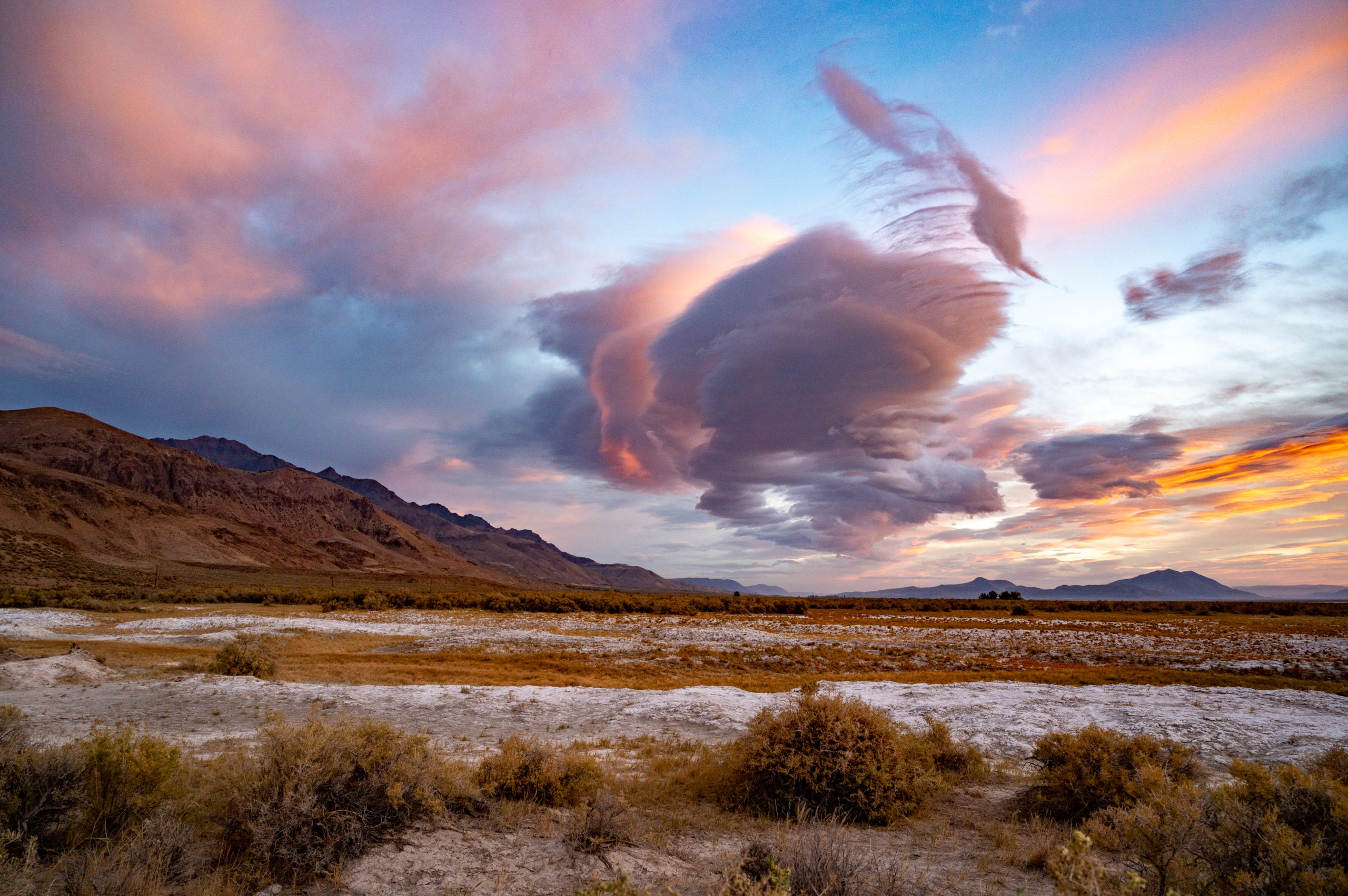
Exploring Alvord Desert and Hot Springs in Oregon
The Alvord Desert in Oregon State is a unique destination. A dried up playa perfect for racing, star gazing, and soaking in a hot spring.
Read MoreRecent Posts

Keep Reading
You Might Also Like
- Destinations
An Incredible One Week Oregon Road Trip
This Oregon road trip itinerary covers some of the remote and rugged areas of Oregon. Discover its natural beauty and unique landscapes.
Read more - Destinations
Best Maui Beaches for Snorkeling and Swimming
Here are the best Maui beaches for both snorkeling and swimming. Whether you're looking to sunbathe, snorkel, or body surf, we've got you covered!
Read more - Destinations
An Amazing Day Trip to Haleakala National Park
Spend an amazing day at Haleakala National Park. Enjoy driving through Maui's Upcountry and then high above the clouds to Halekala's summit.
Read more